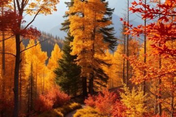
The United States boasts an incredible variety of landscapes, from towering granite peaks to vast desert formations. Many of these natural wonders are accessible through well-maintained paths that don’t require fees, offering unforgettable experiences for outdoor enthusiasts.
These routes challenge both body and mind while rewarding hikers with panoramic vistas. Trails like the South Kaibab in Arizona and the Harding Icefield in Alaska blend physical exertion with awe-inspiring scenery.
This guide focuses on paths that balance accessibility with solitude. You’ll discover hidden gems like North Table Mountain in California and the Sky Bridge Trail in Kentucky—both offering breathtaking views without the crowds.
Table of Contents
Key Takeaways
- Diverse landscapes offer unique experiences across the country.
- Many scenic routes remain uncrowded despite their beauty.
- Trails vary in difficulty, catering to different skill levels.
- Iconic formations like Delicate Arch are accessible via moderate hikes.
- Some paths, like The Narrows in Zion, provide one-of-a-kind adventures.
Why Hike These Breathtaking Trails?
Exploring scenic routes without fees lets adventurers experience nature’s grandeur firsthand. These paths reveal hidden waterfalls, rugged cliffs, and silent forests—all without straining your wallet.

The Allure of Free and Scenic Hikes
Fee-free trails like Arizona’s Wave or Alaska’s Resurrection Pass offer solitude amid iconic landscapes. Seasonal shifts transform these routes—think wildflowers in spring or golden aspens in fall.
Water sources may vanish in summer, so pack extra supplies. Trails blend desert slots, alpine meadows, and coastal bluffs for varied adventures.
How to Prepare for Your Adventure
Gear smartly: Sturdy boots, sun protection, and hydration packs are non-negotiable. For multi-day treks, lightweight tents save energy.
| Essential Gear | Purpose | Trail Example |
|---|---|---|
| GPS device | Navigation in remote areas | Lost Coast Trail |
| Bear spray | Safety in Alaska | Resurrection Pass |
| Water filter | Dry terrain | Grand Staircase |
Timing matters: Avoid midday heat in deserts. Early starts beat crowds at spots like Coyote Buttes North.
Check road conditions and permit rules ahead of time. Some trails limit daily visitors to preserve their magic.
Black Elk Peak, South Dakota
Rising above South Dakota’s Black Hills, Black Elk Peak offers panoramic views of dense forests and rugged rock formations. At 7,242 feet, it’s the highest point east of the Rockies, crowned by a historic stone fire tower built in 1938. The trail blends adventure with glimpses of indigenous and Civilian Conservation Corps history.

Trail Highlights and Unique Features
Cathedral Spires and Harney Fire Lookout dominate the landscape, offering photo-worthy stops. Little Devil’s Tower, a short detour, adds dramatic granite vistas. Pack a satellite SOS device—cell service fades in backcountry zones.
Best Time to Visit and Trailhead Tips
Ideal time: Late June to October avoids snow and delivers mild weather. Summer brings wildflowers, while fall paints the forests gold.
| Tip | Details | Why It Matters |
|---|---|---|
| Arrive early | Sylvan Lake parking fills by 9 AM | Guarantees a spot; $20 fee applies |
| Watch wildlife | Bison and mountain lions roam nearby | Carry bear spray and stay alert |
| Check weather | Sudden storms are common | Pack layers and extra water |
Pro tip: Wind Cave National Park, 30 minutes south, pairs well with your hike. For a quieter route, try the Little Devil’s Tower loop.
Coyote Buttes North: The Wave, Arizona
Few places in the world rival the striking beauty of The Wave in Arizona’s Coyote Buttes North. This surreal landscape, shaped over millions of years, features cross-bedded sandstone with vibrant red and orange swirls. Wind and water carved this geologic wonder from Jurassic-era Navajo Sandstone, creating a terrain unlike any other.

Permit Requirements and What to Expect
Access to The Wave is tightly controlled to protect its fragile rock formations. Only 64 daily permits are issued—48 via a 4-month advance lottery and 16 through a 2-day lottery on Recreation.gov. Note: The BLM may increase fees soon, so check for updates.
Prepare for a 6-mile round-trip hike across rugged terrain. Summer temperatures exceed 100°F, and flash floods pose risks in monsoon season. Pack extra water, a GPS device, and avoid cliff edges—loose sandstone can collapse.
Geologic Wonders Along the Way
Beyond The Wave, explore formations like Melody Arch and The Alcove. These structures reveal layers of sedimentation, contrasting with Zion’s cliffs and Bryce Canyon’s hoodoos.
- Photography tip: Early morning light enhances the striated patterns.
- Safety first: Stay on marked paths to prevent erosion.
- Unique feature: The Alcove’s hollowed chambers echo with desert winds.
This otherworldly landscape demands respect—its beauty is as fragile as it is ancient. Follow Leave No Trace principles to preserve it for future explorers.
First 30 Miles of the Florida Trail
Florida’s untamed wilderness comes alive along the initial stretch of this iconic route. Starting at Oasis Visitor Center, the trail winds through cypress swamps and hardwood hammocks, offering a true backcountry experience.

Navigating Swamps and Wildlife
Winter months bring ideal conditions with lower water levels and fewer insects. The dry season (December-March) makes crossing flooded areas easier while reducing mosquito encounters.
Watch for alligators sunning near water sources and venomous snakes in brushy areas. Bright clothing helps hunters spot you during seasonal activities. Carry a reliable GPS—cell service disappears in dense forests.
Camping in the Heart of the Wilderness
Primitive sites like Oak Hill and Ivy Camp provide rare dry ground. Free permits from Big Cypress National Preserve are required for overnight stays.
- Essential gear: Waterproof tents, bug nets, and hiking poles for muddy sections
- Water strategy: Filter brackish sources before drinking
- Thru-hiker tip: Resupply at 7 Mile and 13 Mile camps
For shorter trips, Anhinga Trail in Everglades National Park offers similar scenery without multi-day commitment. Check weather forecasts—heavy rains quickly flood low-lying areas.
Franconia Ridge Loop, New Hampshire
New Hampshire’s White Mountains hide one of New England’s most breathtaking ridge walks. The Franconia Ridge Loop spans 8.5 miles of strenuous alpine terrain, traversing Mount Lafayette, Mount Lincoln, and Little Haystack. Its proximity to Boston (two-hour drive) and Montreal makes it a favorite for weekend adventurers.

Summit Views and Alpine Terrain
Panoramic vistas stretch across Pemigewasset Wilderness and Franconia Notch State Park from the summits. The exposed ridge demands sturdy footwear—wind speeds often exceed 30 mph. AMC Greenleaf Hut, midway along the route, offers shelter and snacks for overnight stays.
Why This Trail is a Must-Do
Families appreciate shorter segments like Falling Waters Trail, while seasoned hikers tackle the full loop. Historical markers highlight its role in Appalachian Trail culture.
| Tip | Details | Why It Matters |
|---|---|---|
| Start early | Parking fills by 7 AM in peak season | 700+ daily hikers compete for spots |
| Layer up | Summit temps drop 20°F below base | Avoid hypothermia risks |
| Post-hike stop | Flume Gorge or Cannon Mountain tram | Extend the scenic experience |
- Gear rentals: Lincoln, NH shops offer packs and poles.
- Best season: June–October avoids icy ridges.
- Hidden gem: Cloudland Falls’ 80-foot cascade en route.
Grand Canyon: Rim-to-Rim, Arizona
The Grand Canyon’s Rim-to-Rim hike reshapes perspectives with every step through its ancient rock layers. This 24-mile traverse reveals a landscape sculpted over millions of years, where each switchback tells a geologic story.
Planning Your Multi-Day Trek
Gear essentials: A 25–35 lb backpack with hydration systems is critical for the Level 4 difficulty terrain. Bright Angel and South Kaibab trails offer water stations, but always carry extra.
Start at dawn to avoid midday heat. Permits for Phantom Ranch book a year ahead—its creekside campsites are lifesavers.
The Transformative Power of the Canyon
Sunrise at Ooh Aah Point paints the canyon in gold, a world away from daily routines. Many hikers report mental clarity after days immersed in its silence.
- Geologic classrooms: Trailside cliffs expose 1.7 billion years of Earth’s history.
- Cultural threads: Learn Havasupai heritage at tribal-run information boards.
- Volunteer trails: Join cleanup crews to preserve this iconic route.
Pro tip: Plateau Point’s sunset views are unmatched—pack a headlamp for the return hike.
Longs Peak: The Keyhole, Colorado
Colorado’s rugged terrain challenges adventurers with Longs Peak, a 14er offering unparalleled alpine experiences. The 15-mile round trip gains 5,370 feet, crossing boulder fields and exposed ledges where only 50% of hikers succeed. This iconic route demands respect—its Class 3 scrambling and sheer drops test even seasoned climbers.
Challenges of Climbing a 14er
Physical demands: The Keyhole route requires 9–14 hours, with technical sections like the Narrows—a 3-foot ledge with 500-foot drops. Lightning poses greater risks than falls, making pre-dawn starts critical.
Gear non-negotiables: Sturdy boots, layers for summit winds, and a first-aid kit. Winter ascents add ice axes and crampons to the list.
| Season | Conditions | Preparation Tips |
|---|---|---|
| Summer | Clear trails, afternoon storms | Start by 3 AM, pack rain gear |
| Winter | Snow-covered ledges, subzero temps | Check avalanche forecasts, rope teams advised |
Rewards of Reaching the Summit
The summit register documents over a century of ascents, linking hikers to Rocky Mountain National Park’s centennial history. Views stretch 100 miles, showcasing the Diamond’s sheer rock face and the Keyboard of the Winds’ swirling formations.
- Wildlife encounters: Bighorn sheep graze near Boulder Field, while pikas chirp in talus slopes.
- Celebration spots: Estes Park breweries toast successful climbs with local IPAs.
- Geologic classrooms: The Homestretch’s 45-degree slab reveals ancient granite layers.
This climb isn’t just a hike—it’s a rite of passage. Those who conquer it join a legacy of adventurers who’ve braved its heights since the 1920s.
Lost Coast Trail, California
California’s rugged northern shoreline offers one of America’s most unique backpacking experiences. The Lost Coast Trail stretches 24 miles along untouched beaches and towering sea cliffs, where crashing waves and shifting sands create a dynamic landscape. This remote route delivers solitude found in few other coastal areas.
Coastal Beauty and Remote Solitude
Expect dramatic tide pools, sea lion colonies, and driftwood-strewn beaches. The trail alternates between soft sand and rocky outcrops, requiring adaptable footwear with Vibram soles for traction. Freshwater creeks flow into the ocean every few miles—ideal spots to refill bottles after filtering.
Timing is critical. Plan your trip around low tides below 3 feet to pass narrow sections safely. Summer fog often lingers until noon, while fall brings clearer skies and milder weather.
Packing for a Beachside Backpacking Trip
Essential gear includes waterproof dry bags and quick-dry clothing. The BLM mandates bear canisters for food storage—black bears frequently roam this area.
| Item | Purpose | Pro Tip |
|---|---|---|
| Tide chart | Navigation safety | Download NOAA charts to your phone |
| Neoprene socks | Wet crossings | Prevent blisters during stream fords |
| Satellite communicator | Emergency alerts | Garmin inReach works in dead zones |
Camp at established sites 200 feet from water sources. Follow Leave No Trace principles to protect fragile dune ecosystems.
- Footwear strategy: Trail runners for sand, sturdy boots for rocky sections
- Resupply points: Shelter Cove has limited supplies
- Navigation: Carry the King Range map and Avenza app offline
This unforgettable journey blends coastal wilderness with logistical challenges. Proper preparation ensures you’ll experience its magic safely.
Resurrection Pass Trail, Alaska
Alaska’s Resurrection Pass Trail weaves through centuries of indigenous heritage and gold rush history. This 38-mile route through Chugach National Forest connects Hope to Cooper Landing, passing old mining camps and Dena’ina Dené hunting grounds.
Seasonal Wildlife Encounters
Summer brings 16 hours of daylight, with temperatures ranging from 40°F at night to 70°F midday. Watch for moose grazing in willow thickets and bald eagles circling overhead.
Winter transforms the terrain into a snowshoeing paradise. Avalanche awareness is crucial—check forecasts before crossing steep slopes near Devils Creek.
| Season | Wildlife | Gear Essentials |
|---|---|---|
| June-August | Black bears, marmots | Bear spray, bug net |
| September-October | Caribou migrations | Insulated layers |
| November-May | Wolf tracks | Avalanche beacon |
Layers of Human History
Interpretive signs detail how Dena’ina Dené families hunted caribou here for generations. The trail later served gold miners during the 1890s rush—rusted tools still surface near creek beds.
Volunteer with local tribal groups to maintain historic sites. Their Leave No Trace workshops teach sustainable blueberry picking methods.
- Cultural contrast: Unlike the crowded Chilkoot Trail, this route offers solitude
- Russian influence: Look for place names like “Resurrection” from 18th-century explorers
- Modern access: Seven Forest Service cabins provide shelter along the route
Hermit-Tonto-Boucher Loop, Arizona
Deep in the Grand Canyon’s backcountry lies a rugged 23.5-mile loop that tests even experienced hikers. The Hermit-Tonto-Boucher route combines steep descents, exposed scrambles, and breathtaking solitude away from crowded viewpoints.
Escaping Crowds in the Grand Canyon
Unlike popular South Rim trails, this route sees fewer than 20 daily hikers during peak season. The isolation comes with challenges—limited water sources and no cell service demand thorough preparation.
Start at Hermit Trailhead (6,630 feet elevation) where the Santa Fe Railroad once transported tourists. The initial drop through Cathedral Stairs requires careful footing on loose rock and Red Wall Limestone ledges.
Navigating Steep and Exposed Sections
The 2021 rockslide altered sections near Boucher Creek, creating new obstacles. Pack these essentials for safety:
- Rope techniques: 30 feet of cord aids non-technical descents over crumbling sandstone
- Footwear: Stiff-soled boots with aggressive tread for scree slopes
- Hydration: Carry 4+ liters—only Boucher Creek provides reliable water
| Challenge | Solution |
|---|---|
| Redwall scrambles | Three-point contact method |
| Shadeless zones | UV-protective clothing |
| Route-finding | Preloaded GPS waypoints |
Emergency bailout options exist via Tonto Trail to South Rim, but ranger stations are distant. This trail rewards those who respect its raw, untamed nature with canyon perspectives few ever witness.
Ozark Highlands Trail, Arkansas
Few hikers realize Arkansas shelters one of America’s most underrated long-distance trails. The 270-mile Ozark Highlands Trail winds through vibrant forests and past crystal-clear swimming holes, receiving just 10% of the traffic seen on the Appalachian Trail.
Swimming Holes and Scenic Overlooks
Turquoise pools like Falling Water Cascades offer refreshing breaks during summer hikes. The trail’s high bluffs provide panoramic views of the Boston Mountains, particularly stunning at sunrise.
Autumn transforms the terrain into a photographer’s dream. Mid-October brings peak foliage, with sugar maples burning crimson against white oaks’ golden leaves.
Why This Trail is a Hidden Gem
Local “trail angels” maintain secret supply caches near towns like Ozone, continuing Ozark folk traditions of hospitality. The path whispers with history, passing abandoned homesteads and CCC-built stone bridges.
Unlike crowded national parks, you might hike all day without seeing another soul. The nearby Buffalo National River adds wilderness paddling opportunities.
- Navigation: FarOut app works offline with Ozark Highlands Trail maps
- Footwear: Quick-dry sandals for 30+ stream crossings
- Culture: Visit Mountain View for live folk music post-hike
This trail proves unforgettable adventures don’t require famous names or crowded paths—just willingness to explore beyond the beaten track.
PCT from Tuolumne to Agnew Meadow, California
Golden larch trees paint California’s high country each fall along this iconic route. The 21-mile PCT segment showcases the Eastern Sierra’s finest alpine lakes and passes between Yosemite and Mammoth Lakes.
Alpine Lakes and High Passes
Thousand Island Lake dazzles with Banner Peak reflections, while Donohue Pass reveals glacier-carved valleys. The route gains 1,493 feet before descending through larch stands.
YARTS buses run from Mammoth to Tuolumne for $8, simplifying logistics. Free camping at Glass Creek makes pre-hike stays affordable.
Fall Hiking in the Eastern Sierra
Post-Labor Day brings crisp air and fewer crowds. Early-season snow can dust passes by October—pack microspikes and check forecasts.
- Photography hotspots: Minaret Vista at dawn captures fiery larch displays
- Bear safety: Rent canisters in Mammoth; required in Ansel Adams Wilderness
- Recovery soak: Wild Willy’s Hot Springs eases trail-weary muscles
This trail delivers Sierra Nevada’s essence without summit scrambles. Time your visit for autumn’s golden peak when aspen groves glow against granite.
Uncompahgre Peak, Colorado
Colorado’s San Juan Mountains conceal a fourteener that delivers alpine grandeur without the crowds. At 14,321 feet, Uncompahgre Peak dominates the skyline with its distinctive pyramid shape, offering panoramic views of neighboring Wetterhorn Peak and the San Juan range.
Lesser-Known Fourteener with Big Views
The standard route involves class 2 scrambling, making it accessible for fit hikers with proper footwear. Early starts beat both crowds and afternoon storms—the trail sees heavy weekend traffic despite its remote location.
From the summit, you’ll spot five other fourteeners on clear days. The Matterhorn Creek trailhead allows ambitious hikers to combine this with Wetterhorn Peak for an epic two-summit day.
Camping in Alpine Meadows
Dispersed sites near Nellie Creek offer prime stargazing opportunities. Follow Leave No Trace principles in this fragile alpine environment:
- Bear safety: Use odor-proof bags since trees are scarce for traditional hangs
- Weather prep: Pack a NOAA radio for sudden storms—afternoon lightning is common
- Site selection: Camp 200 feet from water sources to protect meadows
The Nellie Creek 2WD trailhead includes accessible campsites, perfect for pre-dawn starts. Summer wildflowers paint the terrain in vibrant hues, while autumn brings golden aspen groves in lower forests.
| Camping Option | Features |
|---|---|
| Nellie Creek | Closest to trailhead, 2WD accessible |
| Henson Creek | More secluded, better star views |
| Matterhorn Creek | Basecamp for dual-peak attempts |
This trip combines high-altitude challenge with stunning rewards. Check detailed weather forecasts—snow can appear unexpectedly even in summer.
Sleeping Giant State Park, Connecticut
Connecticut’s most distinctive landmark isn’t a building—it’s a 739-acre sleeping giant. This park’s namesake mountain formation resembles a reclining figure when viewed from the south, offering 32 miles of well-marked paths through oak-hickory forests.
Quick Escape with Big Rewards
The 3.1-mile Tower trail delivers panoramic views with minimal effort, gaining just 597 feet elevation. Leashed dogs are welcome on this out-and-back route, which ends at a stone observation tower built in the 1930s.
For gentler grades, try the blue-blazed Quinnipiac Trail. Both routes wind through fern-covered slopes and granite outcroppings—perfect for a half-day trip.
Family-Friendly Hiking Options
Park rangers lead nature scavenger hunts where kids can spot:
- Red-tailed hawks circling the tower
- Fossilized dinosaur tracks in stream beds
- Spring wildflowers like trillium and jack-in-the-pulpit
Four picnic shelters with grills make ideal lunch spots after exploring. The playground near the main entrance keeps younger children entertained while adults relax.
| Feature | Details | Accessibility |
|---|---|---|
| Tower Trail | 1.5 hours roundtrip | Sturdy footwear recommended |
| Picnic Areas | Tables & grills | Wheelchair-accessible sites available |
| Nature Center | Weekend programs | Ramp entrance |
After your hike, Quinnipiac River offers calm kayaking waters just 10 minutes east. The park’s mix of easy terrain and educational programs makes it a four-season destination for all skill levels.
Florida Trail Through Rice Creek
Ancient cypress trees tower over the Rice Creek section of the Florida Trail, creating a lush green tunnel through Ocala National Forest. This 10-mile loop combines boardwalk adventures with authentic backcountry experiences, offering a unique blend of accessibility and wilderness immersion.
Exploring Cypress Swamps and Elevated Walkways
The highlight of this trail is Hoffman’s Crossing—a 1,886-foot boardwalk winding through tea-colored waters. Built by the Florida Trail Association, this engineering marvel lets hikers traverse flooded areas while spotting rare birds and turtles.
Key features include:
- Wildlife viewing: Look for ospreys nesting in bald cypress knees
- Seasonal changes: Spring brings migrating warblers and blooming orchids
- Unique terrain: The boardwalk floats just inches above tannin-stained waters
Thru-Hiker Essentials and Shelter Details
The “Rice Creek Hilton” shelter provides critical respite for backpackers. This two-story structure features:
| Feature | Benefit |
|---|---|
| Screened walls | Protection from mosquitoes |
| Elevated sleeping platform | Safety from wildlife |
| Nearby pitcher pump | Non-potable water source |
Spring (November-March) offers the best conditions with moderate temperatures and lower water levels. Always filter water from tannic streams—their brown color comes from natural acids that can affect taste.
Volunteer opportunities with the Florida Trail Association help maintain this special section. Their work ensures the boardwalk remains safe for future adventurers.
Conclusion
America’s wild spaces offer endless opportunities for adventure. From desert arches to alpine ridges, these paths showcase nature’s diversity without entrance fees.
Every journey begins with a single step. Start with short routes like Sleeping Giant, then progress to multi-day treks in national parks. Each experience builds skills while deepening your connection to the land.
Remember your role in conservation. Stay on marked paths, pack out trash, and respect wildlife habitats. Volunteer with local groups to maintain these treasures for future explorers.
Ready for more? Check recreation.gov for permits and trail conditions. Join organizations like the Appalachian Trail Conservancy to give back while exploring new miles.
0 Comments