Three years ago, I traded city life for Switzerland’s mountains—and never looked back. What started as a weekend escape became a passion for discovering trails weaving past alpine lakes, glacial valleys, and villages straight from a postcard. Here, every path feels like a doorway to adventure.
One thing surprised me most: how accessible these jaw-dropping views are. Trains and gondolas whisk you to trailheads within hours, no car needed. Summer (June–September) delivers reliable weather, while autumn offers solitude—just pack layers. (Trust me, I’ve survived sudden August snowstorms!)
This guide shares my favorite routes—each with its own magic. Whether you crave wildflower meadows or rugged peaks, Switzerland’s hiking network connects them all. Let’s dive in.
Table of Contents
Key Takeaways
- Switzerland’s trails are easily reachable by public transport—no car required.
- June through September is ideal for stable weather and open routes.
- Autumn hikes offer fewer crowds but demand preparedness for changing conditions.
- Layering gear is essential—mountain weather shifts fast.
- Trails often interconnect, letting you extend adventures spontaneously.
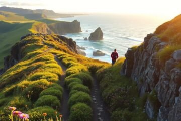
1. Pizol Lake (5 Lake Hike): Eastern Switzerland’s Alpine Gem
Wildsee’s electric blue water stopped me mid-step—my first glimpse of Pizol’s five-lake hike. This 10km loop packs glacier-carved valleys, emerald pools, and ridges where chamois leap between rocks. Eastern Switzerland’s secret? The views are grand, but crowds stay thin.

Trail Overview
Start at Wangs’ gondola (no car needed—just 1hr from Zurich). The lift whisks you to Pizolhütte, skipping 2 hours of steep switchbacks. Purists can hike up, but save energy for the 750m elevation gain ahead.
Wildsee stuns first—its turquoise against gray peaks feels unreal. The trail then weaves past four smaller lakes, each with unique colors. Near the third lake, a hidden cove invites brave swimmers (pack quick-dry gear!).
How to Get There
From Zurich, trains reach Bad Ragaz in 50 minutes. Bus 451 goes to Wangs, where the gondola begins. Pro tip: Catch the 2pm ascent for golden light on the Gaffia descent—it turns the cliffs fiery orange.
Key Stats: Distance, Elevation, and Time
- Distance: 10km loop
- Elevation: 750m gain
- Duration: 4-5 hours
Watch for rocky sections near Schottensee—my boots saved me from twisted ankles. Once, I squinted at distant figures scaling a ridge, only to realize they were hikers, not mountain goats!
Cap the day in Wangs village. Gasthaus Alpenrose serves hearty rösti with local cider. Their patio overlooks the very peaks you conquered.
2. Oeschinensee: Bernese Alps’ Crystal-Clear Wonder
Oeschinensee’s water was so clear, I swore I could count every pebble 30 feet below. This 8km loop in the Bernese Oberland delivers two extremes: heart-pounding cliffside trails and lakeside tranquility. One minute, you’re gripping cables along Heuberg ridge; the next, you’re skipping stones into glacial meltwater.

Why This Hike Stands Out
The views from Heuberg are legendary—360-degree panoramas of the Blüemlisalp massif. But the real magic? Descending to the lake’s shore, where you can rent wooden rowboats (or watch brave souls dive in). Pro tip: Pack waterproof pants. My hat learned the hard way when a rogue wave claimed it as tribute.
Logistics: Cable Car vs. Hiking Up
The cable car from Kandersteg saves 2 hours and 480m of elevation gain. Catch the first ascent at 8:30am, but note the last descent is 5:15pm—miss it, and you’re hiking down in the dark. For purists, the trail up starts near the campground, weaving through pine forests.
Steep Sections and Safety Tips
Near Oberbärgli, the sections of loose gravel demand focus. My trick? Plant your poles like a mountain goat and step deliberately. For lunch, veer off-trail to a flat rock overlooking the lake—it’s marked by a tiny cairn.
- Distance: 8km loop
- Elevation gain: 480m
- Duration: 3–4 hours
- Don’t miss: Älplere cheese at the lakeside hut
Fun fact: The lake’s color shifts from turquoise to deep blue by afternoon. I once sat there so long, a curious marmot tried to share my sandwich!
3. Seealpsee (Alpstein): Easy Beauty with a Cliffside Restaurant
Äscher Restaurant clung to the cliffside like a stubborn barnacle—I ordered rösti with a side of vertigo. Below, Seealpsee’s glassy water reflected the Alpstein peaks, a postcard come to life. This 2.5km hike packs meadows, a swim-worthy lake, and a dining experience dangling over a 100m drop.

Two Routes to the Lake
From Wasserauen, choose your adventure:
- The Grind: Follow the service road (266m elevation gain). It’s steep but rewards with wildflower bursts and cowbell symphonies.
- The Cheat Code: Ride the Ebenalp cable car, then descend 20 minutes to the lake. Ideal for families or time-crunched hikers.
Pro tip: Combine both—hike up, cable-car down. My calves thanked me.
Don’t Miss the Äscher Restaurant
Perched in a cave, Äscher serves rösti portions so huge, they could fuel a hike to Mars. Go before 11am or after 2pm to dodge queues. Their hazelnut schnapps—a local digestif—tastes like liquid gold. (One shot warmed me up for the cliffside photo op.)
Family-Friendly Options
Rent rowboats at the lake (CHF 15/hour). My kids paddled while I lounged on west-shore boulders—sunset turns them pink. For shorter legs, the flat trail around the lake takes 45 minutes. Pack swimsuits: the water’s chilly but irresistible.
Quick Stats:
- Distance: 2.5km (one way)
- Elevation: 266m gain (service road)
- Time: 1–1.5 hours up
4. Aletsch Glacier Panorama Trail: Walk Beside a Frozen Giant
Standing on the edge of Aletsch Glacier, I felt dwarfed—23 kilometers of ice stretched before me like a frozen river carved by giants. This UNESCO-listed trail offers more than views; it’s a front-row seat to Earth’s raw power. Listen closely, and you’ll hear the glacier’s creaks—a sonic reminder that this landscape is alive.

Glacier Facts and Views
From the Musfluh Cable Car, 32 peaks over 4,000m pierce the horizon. The trail traces the glacier’s eastern flank, where climate change markers—recession lines etched into rock—tell a silent story. Pack binoculars: distant figures on the ice are often researchers measuring its retreat.
Starting Point: Riederalp or Fiescheralp?
- Riederalp: Quaint village charm, but adds 45 minutes to the hike. Worth it for the wood-smoked cheese at Berghaus Hohfluh.
- Fiescheralp: Faster access (just 10 minutes to the viewpoint) and gentler elevation gain. Skip breakfast here—the cable car station’s espresso is weak.
Best Time to Avoid Crowds
July and August draw crowds, but catch the first gondola at 7am for solitude. By 10am, the light turns the ice electric blue. Late September offers crisp air and golden larches—just watch for early snow. My secret? Weekdays after 3pm, when day-trippers leave.
Telescopic poles are lifesavers on moraine rubble. Near Märjelenseen, the lake’s chalky waters mirror the sky—swim if you dare (it’s colder than it looks). One way to grasp the glacier’s scale? Compare it to Manhattan: Aletsch is longer than the island.
5. Bachalpsee: Grindelwald’s Postcard-Perfect Lake
Morning mist hovered over Bachalpsee like a delicate veil—I held my breath as the sun burned it away, revealing a mirror so flawless it doubled the surrounding peaks. This alpine lake near Grindelwald delivers views worthy of a painter’s canvas, with minimal effort required. A quick cable car ride and gentle 1.45-hour trail make it accessible for all.

First Gondola Access
From Grindelwald, the cable car to First station takes 25 minutes. Grab a window seat on the left side—you’ll spot the Wetterhorn’s jagged ridges before the trail even begins. Pro tip: Arrive by 8am to avoid queues and catch the lake’s glassy stillness. The elevation gain is just 188m, mostly spread across gentle switchbacks.
Picnic Spots and Photo Ops
Pack treats from Grindelwald’s local bakeries—buttery Bretzeli cookies pair perfectly with the views. Two prime spots:
- North shore: Flat rocks ideal for tripod setups. Dawn transforms the water into a mirror.
- West inlet: Secluded for swims (if you brave the chill). Watch for marmots—they’ll photobomb if you’re quiet.
Extending to Faulhorn
For an epic add-on, continue 2.5 hours uphill to Berghotel Faulhorn. The reward? A 180° panorama of the Bernese Alps. Pack layers—the ridge way gets windy. I once lingered too long capturing the views and had to jog back before sunset!
| Route Option | Distance | Elevation Gain | Time |
|---|---|---|---|
| Bachalpsee Round Trip | 6km | 188m | 1.45 hours |
| Faulhorn Extension | 12km | 730m | 4.5 hours |
Avoid afternoons—selfie sticks multiply like alpine wildflowers. For solitude, visit midweek in September when larches turn gold. Fun fact: The lake’s name means “bench lake,” named for its flat shoreline. Perfect for that picnic you’ve been planning.
6. Zermatt 5 Lakes Hike: Matterhorn Reflections Galore
Five lakes, one iconic peak—Zermatt’s legendary hike blends alpine beauty with refreshing swim breaks. This 9km trail winds past turquoise pools, each framing the Matterhorn like a carefully composed postcard. With just 241m of elevation gain, it’s a visual feast without the thigh burn.

Lakes You’ll Pass (and Swim In)
Ranked by swim-worthiness:
- Leisee: Shallow and sun-warmed (the only lake where I’ve seen toddlers splashing).
- Stellisee: Mirror-like at dawn—set your alarm for 6am to capture the perfect reflection.
- Grindjisee: Icy but stunning, with emerald hues from glacial flour.
Pro tip: Pack a waterproof phone case. I dropped mine while kneeling to photograph Grünsee’s jade waters—thankfully, it survived.
Chez Vrony Hut Stop
This cliffside hut’s secret? Their Höhenwind cocktail—local pear brandy with thyme syrup. Pair it with air-dried beef from Valais cows grazing below. Time your stop for 11am when sunlight floods the patio, turning the Matterhorn gold.
Blauherd to Sunnegga Route
From Blauherd, the trail descends through larch forests. Watch for ibex near Grünsee—they’re bolder here than elsewhere in Zermatt. End at Sunnegga station, where the cable car zips you back to town in 8 minutes. No car? No problem. Trains from Visp connect seamlessly.
My proudest moment? Completing the hike in lederhosen (a bet gone right). The wool lining kept me warm during my “Alpine sauna” routine—swim, sunbathe, repeat. Just avoid cotton unless you enjoy hiking in soggy clothes.
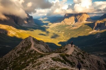
7. Rigi Panoramic Trail: Lakeside Views for All Skill Levels
Cowbells chimed in the distance, a soundtrack to Rigi’s rolling meadows—this trail proves Switzerland’s beauty isn’t just for hardcore hikers. With gentle slopes and jaw-dropping views of Lake Lucerne, it’s a paradise for families and first-timers. Even better? No car is required—just hop on a historic cog railway.

Cog Railway: Arth Goldau vs. Vitznau
Two routes lead to Rigi Kulm, the trail’s start point. Vitznau’s red train climbs past waterfalls—ideal for photographers. Arth Goldau’s blue train winds through forests, shaving 15 minutes off the time. Pro tip: Sit on the right side from Vitznau for lakeside panoramas.
| Route | Duration | Scenic Highlights |
|---|---|---|
| Vitznau | 30 mins | Waterfalls, lake vistas |
| Arth Goldau | 45 mins | Forests, distant Alps |
Kid-Friendly Hacks
Strollers roll easily on the wide gravel path to Rigi Kaltbad. Turn the trip into a treasure hunt—count cowbells or spot yellow arnica flowers. For tiny legs, take the cable car down from Kaltbad (saves 1.5 hours). Pack snacks: Bergrestaurant Rigi Staffel serves mini schnitzels.
Ferry Combos and Sunset Cruises
Book a Kombiticket to pair your hike with a Lake Lucerne ferry. The 5pm cruise from Vitznau turns the water molten gold—worth the extra CHF 12. No elevation gain here, just alpine glow and Swiss wine. My kids waved at our morning trail from the deck, spotting where we’d picnicked.
- Distance: 6.9km (one way)
- Elevation gain: 245m
- Don’t miss: Sunset at Chänzeli viewpoint
8. The Hardergrat Trail: Ridgewalking for Thrill-Seekers
My hands trembled as I inched along the knife-edge ridge—one misstep meant a 500m plunge. Hardergrat isn’t a trail; it’s an 18km tightrope walk above Lake Brienz, where gusts can shove you sideways. With 3,000m of elevation gain, this route rewards stamina with spine-tingling views—if you dare.

Why the “Dangerous” Reputation?
Three sections test nerves: Sidelhorn’s crumbling limestone, Tanzbodeli’s 30cm-wide spine, and the final descent’s loose scree. I learned the hard way—my hiking pole snapped mid-crossing, leaving me hugging the rock face. Local guides call it “Switzerland’s most exposed day hike” for good reason.
Gear That Saved My Knees
- Poles with grip tape: Wrap duct tape around handles for sweaty-palm security.
- Approach shoes: Sticky rubber soles grip polished rock better than boots.
- Bum slide technique: Scoot down steep gravel on your rear—embrace the dirt.
Beat the Clock: Cable Car Logistics
The last car from Brienzer Rothorn departs at 4:45pm sharp. Miss it, and you’re facing a 3-hour hike down in the dark. Start by 7am to allow time for photo stops and weather delays. Pro tip: Check the webcam at Rothorn station—if clouds obscure the ridge, postpone.
Once, fog erased the trail entirely. I navigated by feeling for boot-scuffed rocks until the sun burned through. That’s Hardergrat’s lesson: respect the mountains, and they’ll reward you with adrenaline-fueled memories.
9. Triftbrücke: A Suspension Bridge Over Glacier Melt
Wind howled through the steel cables as I took my first step onto Triftbrücke—170 meters above a glacier-carved abyss. This trail isn’t just a hike; it’s a front-row seat to climate change, where a vanishing glacier and a swaying bridge tell parallel stories of fragility and resilience.

Booking the Triftbahn Gondola
The tiny gondola fits just 8 people—reserve online at 7am sharp. Weekday slots vanish fastest. Miss out? The 2.5-hour hike up gains 695m of elevation gain, but the way down is brutal on knees. Pro tip: Duct-tape your poles’ grips. Mine slipped mid-ascent, nearly tumbling into the gorge.
| Option | Duration | Cost (CHF) |
|---|---|---|
| Gondola (round trip) | 10 mins | 34 |
| Hike up | 2.5 hours | 0 |
Glacier Recession Insights
Rust-colored markers dot the cliffs—each shows where the glacier reached in past decades. Binoculars reveal ice caves collapsing like sandcastles. The bridge itself? Built in 2009 after the original path melted away. Pack a jacket: the wind chills even in summer.
Near the upper station, a hidden waterfall cascades down mossy rocks. Few notice it—most rush to the bridge. Sit here awhile. The roar of water drowns out crowds, a rare moment of solitude.
Short but Steep Hike
The final 20 minutes to the bridge climb sharply. Focus on the trail, not the drop. Locals joke: “Look at your boots, not the view.” Once across, double back via the moraine for a quieter trip down. No car? Postbuses from Meiringen run hourly.
- Don’t miss: Sunset turns the glacier pink—but catch the last gondola by 5pm.
- Gear: Knee braces for the descent; the gravel slips like ball bearings.
- Climate note: The glacier loses 30m yearly. Visit before it’s just a memory.
10. Tour du Lac de Moiry: Valais’ Turquoise Loop
The wind whipped glacial silt into miniature dust devils as I stepped onto Moiry’s lunar-like moraine—this wasn’t Earth, it was Mars with alpenglow. This 13.4km loop wraps around Switzerland’s most surreal lake, where trail markers lead you past ice-carved cliffs and secret wildflower pockets. With 567m of elevation gain, it’s a moderate day trip that feels like stepping into a fantasy novel.

Glacial Moraine Scramble
The eastern moraine looks like a giant dumped gravel—jagged rocks and twisted metal from old mining gear. Trekking poles are lifesavers here. I once spotted a herd of ibex sunbathing on the warm stones, their horns glowing gold at sunset.
Two route options:
- Clockwise: Tackles the steepest sections early (ideal for fresh legs).
- Counterclockwise: Saves the lake’s views for the finale—perfect for golden hour photos.
Parking and Dam Start Point
Park at Moiry Dam’s lot (free before 8am). The concrete arch makes a killer photo op—shoot from the west side at noon for shadow play. No car? Postbuses from Grimentz run hourly. Pro tip: Fill bottles at the dam’s spring; it’s the coldest water you’ll ever taste.
Nearby Zermatt Detours
Extend your trip with a train to Zermatt (90 minutes). The Matterhorn’s trails connect seamlessly—just pack extra snacks. My secret? Wild camp above St. Luc for sunrise views of both ranges. Rangers tolerate discreet tents if you arrive late and leave early.
| Stats | Details |
|---|---|
| Distance | 13.4km loop |
| Elevation Gain | 567m |
| Swim Spot | Hidden cove near Pont de la Gouille |
Gear up: Early-season hikers need crampons for icy patches near the glacier tongue. By August, it’s all wildflowers and sunbathing lizards—nature’s mood swings at their finest.
Conclusion: Your Swiss Hiking Adventure Awaits
A steaming fondue pot waited at the trail’s end—my reward for conquering another alpine pass. Whether you’re plotting hikes Switzerland classics or hidden gems, these trails promise memories as crisp as mountain air.
Base yourself in Interlaken for easy access to Grindelwald and Lauterbrunnen. Multi-day passes like the Swiss Travel Pass save time and cash—unlimited trains, buses, and even boats. Prefer a DIY trip? Grab my free packing checklist (link below) to prep for changing conditions.
After dusty boots, refuel at Chäs Biente in Grindelwald. Their truffle fondue pairs perfectly with summit stories. Visit late September for golden larches and quiet paths—just pack extra layers.
Tag me in your summit selfies—I’ll cheer you on! Every turn here reveals a new secret. Ready to lace up?
0 Comments