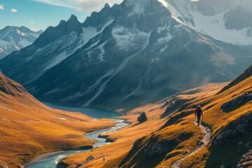
Stretching 179km along Ireland’s stunning southwest coast, this circular trail offers a mix of rugged cliffs, golden beaches, and rich Gaelic heritage. Starting in Tralee, it winds through diverse landscapes, from Slieve Mish mountains to the iconic Slea Head. Expect 6-10 days of moderate trekking, with highlights like Mount Brandon’s panoramic views and ancient archaeological sites.
Unlike busier routes, this path immerses hikers in authentic Irish culture. Traditional music sessions, historic beehive huts, and the Wild Atlantic Way connection add depth to the journey. Well-marked paths and varied terrain—from forest walks to coastal boardwalks—make navigation straightforward for experienced adventurers.
Table of Contents
Key Takeaways
- 179km loop blending mountains, beaches, and cultural sites
- 6-10 day trek with moderate difficulty
- Less crowded than the Ring of Kerry
- Connects to the Wild Atlantic Way for extended trips
- Rich Gaelic heritage with music and ancient ruins
Introduction to the Dingle Way
Winding through County Kerry’s untouched landscapes, this trail blends Gaelic heritage with cinematic views. Pass traditional villages where Irish remains the first language, and explore over 40 archaeological wonders like Gallarus Oratory. From Fermoyle Strand’s golden sands to Slieve Mish Mountains’ rugged peaks, the route packs diverse scenery into every mile.

What Makes This Trail Unique?
Culture thrives here. As a Gaeltacht region, Gaelic music and language fill local pubs. Ancient beehive huts and ogham stones dot the path, whispering tales of early settlers. The trail also skirts filming sites for Star Wars, merging Hollywood glamour with timeless history.
Nature steals the show too. Walk 20km of beaches like Inch, where waves crash against dunes. Then ascend to Ireland’s second-highest peak, Mount Brandon, for panoramas that stretch to the Blasket Islands.
Why Choose This Peninsula?
Unlike crowded tourist spots, this route offers authenticity. Stay in family-run guesthouses, and savor homemade brown bread after a day trekking coastal cliffs. The table below captures key contrasts:
| Feature | Dingle Peninsula | Commercialized Trails |
|---|---|---|
| Language | Gaelic widely spoken | English-dominated |
| Scenery | Slieve Mish Mountains + beaches | Single terrain type |
| Crowds | Low | High |
| History | 40+ archaeological sites | Minimal ancient relics |
Whether you seek solitude or storytelling, this path delivers both. Pack your boots—and a phrasebook—for an adventure like no other.
Planning Your Dingle Way Adventure
Preparing for this Irish trek requires smart timing and the right equipment. With changeable weather conditions and varied terrain, advance planning ensures comfort and safety. Below, we break down seasonal strategies and gear essentials.

Best Time to Hike
Prime months run from March to October, with July and August offering the warmest weather conditions (61°F highs). Autumn brings vibrant foliage but expect mud and wind, especially near coastal sections.
| Season | Pros | Cons |
|---|---|---|
| Spring (Mar–May) | Wildflowers, fewer crowds | Unpredictable rain |
| Summer (Jun–Aug) | Warmest temps, long days | Peak booking demand |
| Fall (Sep–Oct) | Stunning colors, cooler air | Muddy paths |
Essential Gear and Packing Tips
Pack for rapid shifts between sun and rain. A 15–20lb daily load is ideal for the 9–10 days on the trail. Key items include:
- Waterproof layers: Jacket and gaiters for soggy sections
- Navigation tools: OS Maps and a compass (cell service is spotty)
- Footcare kit: Moisture-wicking socks and blister patches
Book accommodation 6 months ahead for summer stays—85% of lodgings fill fast. Consider luggage transfer services to lighten your load. For more hiking tips, explore our guide to day hiking essentials.
Getting to the Dingle Way
Tralee serves as the gateway to this legendary route, accessible by air, rail, and road. Multiple transport options connect major cities to County Kerry, making arrival convenient for international travelers. Planning your approach in advance ensures more days spent enjoying the scenery rather than navigating logistics.

Arriving in Tralee
Kerry Airport (KIR) offers direct flights from Dublin, London, and Frankfurt—ideal for minimizing connections. Ground transfers take just 45 minutes to reach Tralee Dingle‘s town center. Alternative airports include:
- Shannon: 2h50-3h15 by bus
- Cork: 2hr train from Kent Station
- Dublin: 4.5hr direct bus service
Transportation Options
Choose your preferred method based on budget and schedule flexibility:
| Method | Time | Cost |
|---|---|---|
| Train (Tralee Casement) | 3hr from Dublin | €25-40 |
| Bus (Expressway) | 4.5hr from Dublin | €15-25 |
| Car Rental | Flexible | €40+/day |
For trailhead access, taxis run from Tralee Dingle to Camp village (20min). Use apps like RealTime Ireland for live bus tracking. Multi-day hikers can park securely at Tralee’s designated lots for €8/day.
Pro tip: Luggage transfer services let you hike light while your gear moves ahead to each stop. This option maximizes enjoyment along the coastal route.
Trail Overview and Key Stats
Covering 114 miles of diverse terrain, this trail challenges hikers with elevation gains and coastal paths. The total ascent reaches 2,900m (9,514ft), spread across 8 stages averaging 14–18 miles daily. Prepare for boreens (small roads), beach sand, and occasional mountain fog.

Distance and Duration
Most adventurers complete the loop in 6–10 days, depending on pace. Stage 3 is the longest at 23Km (14.3 miles), while Stage 6—Feohanagh to Cloghane—tests endurance with steep climbs.
- Elevation peaks: Shoulder of Mount Brandon (640m/2,100ft)
- Surface variety: 70% boreens, 30% beaches/cliff paths
- Emergency exits: Teach Tae B&B, The Old Anchor Inn
Difficulty Level
Rated moderate, the route suits those comfortable walking 6 hours daily with a pack. Compared to Ireland’s Wicklow Way, it offers more coastal sections but fewer dense forests.
Navigation aids like the Macs Adventure app help in foggy mountain zones. For hiking prep tips, explore our guide to planning multi-day hikes.
Hike the Dingle Way in Ireland: Coastal Routes & Tips
This path unveils Europe’s wild edge, blending dramatic coastal routes with rugged mountain passes. Expect golden beaches, sheer cliffs, and Gaelic history etched into every mile.

Coastal Gems Not to Miss
Slea Head crowns the peninsula as mainland Europe’s westernmost point. Waves crash below while the Blasket Islands float on the horizon—reachable by ferry from Dunquin Pier.
Fermoyle Strand stretches 11km, perfect for sunrise walks. Check tide tables to avoid getting cut off by rising waters near historic shipwrecks.
Conquering the Peaks
Brandon Mountain’s 655m ascent challenges even seasoned hikers over 4km. Pack microspikes for Masatiompan Ridge’s rocky traverse—rewards include panoramic views to the Aran Islands.
| Feature | Coastal Sections | Mountain Zones |
|---|---|---|
| Terrain | Sandy beaches, cliff paths | Steep scree, exposed ridges |
| Highlights | Slea Head sunsets, grey seals | Brandon summit vistas |
| Gear | Quick-dry shoes, tide charts | Trekking poles, windproof layers |
Wildlife thrives here. Spot basking sharks offshore or ancient beehive huts clinging to hillsides. For photographers, Dunmore Head’s sunset views are unmatched.
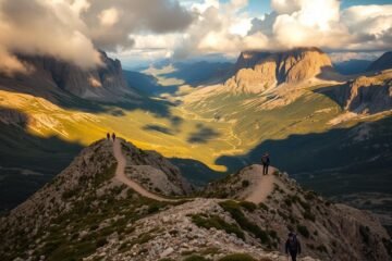
Detailed Trail Stages
Breaking down this epic journey into manageable sections helps hikers prepare for each unique challenge. From rolling hills to sweeping coastal views, every stage offers distinct terrain and highlights. Below, we explore all eight segments with key stats and landmarks.
Stage 1: Tralee to Camp
Kick off with 18km through historic landscapes. The route passes Blennerville Windmill and crosses Derryquay River Bridge before ending at An Cúinne Pub. Expect rustic trails and occasional river crossings during this 5-7 hour segment.
Stage 2: Camp to Annascaul
This 17km section climbs through forests with panoramic views of Dingle Bay. Stop at the famous South Pole Inn, honoring Antarctic explorer Tom Crean. Moderate difficulty makes it ideal for building stamina early in the trip.
Stage 3: Annascaul to Dingle
Cover 23km past Minard Castle ruins and stone cottages. The Kerry Camino concludes here, offering rewarding views of Brandon Bay. Pack extra snacks—this stretch takes 5-7 hours at a steady pace.
Stage 4: Dingle to Dunquin
Walk 20km along beaches with Blasket Islands vistas. Choose between coastal paths or inland roads based on weather conditions. Don’t miss Gallarus Castle, a 15th-century landmark near the route’s end.
Stage 5: Dunquin to Feohanagh
Many consider this 20km segment the most scenic. Pass ancient Ogham Stones and watch for rare Natterjack Toads near Sybil Point. Sturdy boots handle the rocky shoreline sections best.
Stage 6: Feohanagh to Cloghane
The toughest challenge spans 24km with a 655m ascent up Mount Brandon. Steep descents require trekking poles, but summit views stretch to the Aran Islands. Allow 6-7 hours for this demanding day.
Stage 7: Cloghane to Castlegregory
At 29km, this longest stage features flooded bridges and wading sections. Miles of sandy beaches reward those who complete the 7-9 hour trek. Check tide tables before crossing Finglas River.
Stage 8: Castlegregory to Tralee
The final 27km loop returns to Blennerville Windmill. Gentle terrain makes for an easier 6.5-8.5 hour conclusion. Celebrate with local seafood in Tralee after conquering all 179km.
Pro tip: Download the Macs Adventure app for real-time navigation aids during foggy mountain sections. Always carry waterproof layers—weather shifts rapidly along coastal stretches.
Must-See Attractions Along the Trail
From medieval churches to windswept islands, the journey is packed with iconic stops. Each landmark reveals layers of history while offering stunning views of the Atlantic. Whether exploring alone or with a local guide, these highlights deserve extra time.
Island Adventures: Blasket Islands and Dunquin Pier
Blasket Ferries operate from Dun Chaoin Pier, with 20-minute crossings to Great Blasket Island. Known as “The Sheep Highway,” this pier once herded livestock to island pastures. Time your visit with the ferry schedules to explore abandoned villages and spot seals basking on rocks.
Don’t miss Kruger’s Bar, Europe’s most westerly pub, where filmmakers and travelers swap stories. The Blasket Centre museum (€5 entry) preserves island life through interactive exhibits. For the best view, hike to Dunmore Head at sunset.
Stone Chronicles: Gallarus Oratory and Ancient Sites
The 7th-century Gallarus Oratory stands like an upturned boat, built without mortar. Local legend claims looking through its window guarantees heavenly salvation. Nearby, Minard Castle’s rubble tells of 16th-century sieges—bring a guide to decode its dramatic past.
Photograph these sites respectfully, avoiding touching fragile ogham stones. Hidden gems like Gallarus Castle (built by the FitzGeralds) reward those who venture off main paths.
| Experience | Self-Guided | Guided Tour |
|---|---|---|
| Blasket Islands | Flexible ferry times | Includes Gaelic storytelling |
| Gallarus Oratory | Free exploration | Archaeological insights |
| Photography | Personal pace | Pro lighting tips |
| Hidden Sites | Adventure rewards | Guaranteed access |
Coumeenoole Beach offers dramatic coastal views between historical explorations. Whether deciphering ogham stones or chatting with island descendants, every stop connects you deeper with this living landscape.
Where to Stay on the Dingle Way
Quality lodging transforms a good adventure into an unforgettable experience. From seaside guesthouses to mountain-view B&Bs, the peninsula offers diverse accommodation for every preference and budget. Book early—especially for summer nights when 85% of rooms fill months ahead.
Comfortable Stays Along the Route
Greenmount House tops luxury picks with panoramic bay views and gourmet breakfasts (€120-180/night). For mid-range options, Dingle Skellig Hotel provides spa access after long trekking days.
Family-run places like The Old Anchor Inn offer authentic Irish hospitality with ensuite rooms and mountain vistas. Brosnans B&B combines quiet locations with easy town access—perfect for unwinding.
Affordable Alternatives
Budget travelers enjoy designated campsites (€15-25/night) with basic facilities. Hostels like Rainbow Hostel provide luggage storage and communal kitchens for hikers watching expenses.
Glamping pods at Inch Beach deliver sea views without sacrificing comfort. These options include heated beds and private decks.
| Type | Average Cost/Night | Best For |
|---|---|---|
| Luxury Hotels | €120-180 | Comfort seekers |
| B&Bs | €70-110 | Cultural immersion |
| Hostels | €25-40 | Solo travelers |
| Camping | €15-25 | Adventure purists |
Pro tip: Many accommodation providers offer luggage transfer services (€15-25/bag) to lighten your load between places. Check cancellation policies—some require 48-hour notices during peak season.
Dining and Local Cuisine
Fuel your adventure with authentic flavors along this iconic trail. The peninsula’s eateries blend fresh Atlantic catches with time-honored recipes, creating memorable places to refuel. Whether craving seafood chowder or vegan boxty pancakes, every meal here tells a story.
Best Pubs and Restaurants
Foxy John’s doubles as a hardware store by day, transforming into a lively pub at night—don’t miss their Dingle Gin cocktails. For harbor views, The Boat Yard Restaurant serves crab claws pulled straight from nearby waters.
Music lovers flock to McCarthy’s Bar for nightly trad sessions. Clapping along is encouraged when musicians finish sets. South Pole Inn honors explorer Tom Crean with walls lined with Antarctic memorabilia.
Traditional Irish Dishes to Try
Start mornings with a full Irish breakfast featuring black pudding. Warm up with shepherd’s pie at day’s end—layers of lamb and mashed potatoes baked golden.
Unique things to sample include Murphy’s seaweed ice cream and Dingle pie stuffed with local lamb. Vegetarians enjoy roasted root vegetable stews at many places.
| Dining Experience | Must-Try | Budget Tip |
|---|---|---|
| Pub Grub | Seafood chowder | Lunch specials before 3pm |
| Markets | Artisan cheeses | Pack sandwiches for trail |
| Distilleries | Whiskey tasting | Shared flights save €10+ |
For a guided experience, join Dingle Food Tours (€65) to sample 10+ local specialties. Their experts share hidden gems like bacon-wrapped dates at backstreet cafes.
Evening pub etiquette? Buy musicians a pint if you’ve enjoyed their set—it’s the ultimate local compliment. This culinary journey makes every mile more rewarding.
Weather Conditions and Preparation
Sixty-one inches of annual rainfall means waterproof gear isn’t optional—it’s essential. The peninsula’s weather shifts rapidly, with coastal winds reaching 40mph and summer UV indexes hitting 5-7. Smart preparation turns challenging conditions into manageable adventures.
Managing Rain and Wind
Pack a three-layer system: moisture-wicking base, insulating mid-layer, and waterproof shell. Top brands like Arc’teryx and Patagonia offer breathable jackets that withstand horizontal rain. Don’t forget these essentials:
- Waterproof gaiters for boggy sections
- Sealed seams on all outerwear
- Quick-dry gloves with grip texture
Hypothermia risks increase when wet and windy conditions combine. Pack emergency blankets and know rain gear recommendations from experienced trekkers.
Seasonal Timing Strategies
Mid-spring to October offers the most stable weather, though no time guarantees dry trails. Consider these monthly factors:
| Month | Daylight | Precipitation |
|---|---|---|
| May | 16 hours | 2.8 inches |
| July | 17 hours | 3.1 inches |
| September | 13 hours | 4.0 inches |
Download Windy or Met Éireann apps for real-time updates. Morning starts beat afternoon showers, a critical part of daily planning. Sturdy boots handle muddy terrain when autumn rains arrive.
Remember: The right time and gear make every part of the journey enjoyable, regardless of what the Atlantic delivers.
Safety Tips for Hikers
Smart preparation ensures a safe and enjoyable experience on rugged trails. From sudden weather shifts to tricky river crossings, awareness of hazards keeps adventures on track.
Navigating Challenging Terrain
River crossings require caution—face upstream, use poles, and unbuckle backpack straps. For foggy mountain zones like Connor’s Pass, a backup paper map complements GPS devices.
Wildlife encounters are rare but possible. Store food securely and give grazing livestock space. Follow yellow walking man symbols to stay on the correct path.
| Navigation Tool | Pros | Cons |
|---|---|---|
| GPS Device | Real-time tracking | Battery-dependent |
| Paper Map | No signal needed | Requires practice |
Emergency Contacts and Resources
Dial 112 or 999 for mountain rescue. Pack a first aid kit with:
- Bandages and antiseptic wipes
- Emergency blanket
- Pain relievers
Check trail markers for updates on closed sections. Travel insurance should cover evacuation from remote areas.
Cultural Insights and Local Customs
Immerse yourself in living Gaelic traditions along this storied route. The dingle peninsula thrives as a Gaeltacht region, where Irish remains the first language in villages. Beyond landscapes, the real magic lies in whispered tales of ancient settlers and fiddle tunes echoing in cozy pubs.
Gaelic Traditions and Language
Locals cherish their heritage, offering a guide to authentic things like:
- Music sessions: Nightly trad performances where clapping is encouraged
- Phrases to know: “Sláinte” (Cheers) for toasting fellow hikers
- Storytelling: Pub nights recounting myths of the Blasket Islands
Festivals and Events
Time your trek with these highlights for a richer experience:
- Dingle Folk Festival (October): Fiddle workshops and dance demos
- Food Festival: Sample seaweed ice cream and lamb pies
- Artisan workshops: Pottery and wool-weaving classes
Respect local customs—ask before photographing sacred sites, and join sing-alongs at McCarthy’s Bar. The dingle peninsula rewards those who embrace its rhythm.
Wildlife and Natural Beauty
Nature lovers will find endless discoveries along this diverse ecological corridor. The peninsula shelters 600+ plant species and rare creatures like the Natterjack toad. Whether scanning cliffs for seabirds or photographing wild orchids, every day brings new views.
Coastal and Mountain Ecosystems
Golden beaches meet rugged cliffs where waves carve dramatic formations. Inland, Mount Brandon offers panoramic views of the Atlantic and patchwork farmland. These contrasting zones create unique habitats.
| Feature | Coastal Zone | Mountain Zone |
|---|---|---|
| Wildlife | Grey seals, basking sharks | Red deer, peregrine falcons |
| Plants | Sea thrift, samphire | Alpine saxifrage, bog cotton |
| Best Time | Low tide for tidal pools | Summer for clear views |
Unique Flora and Fauna
Three things make this area special:
- Natterjack toads: Europe’s rarest amphibian breeds near Inch Beach
- Fungie’s legacy: The famous dolphin patrolled waters for 37 years
- Protected flowers: Early purple orchids bloom in spring
Boat tours reveal marine life, while guided walks showcase geological wonders. The Slieve Mish foothills form a critical part of the ecosystem.
Birdwatchers should pack binoculars for puffin colonies near Slea Head. The mix of sea and mountain scenery creates unmatched photo opportunities.
Alternative Routes and Shortcuts
Discover shorter loops and detours for those with limited time or varied interests. The HiiKER app marks alternate paths as ‘ALT’ (turquoise) or ‘SPUR’ (pink) for easy navigation. These variations let you tailor the experience to your pace and preferences.
Loop Walks and Side Trips
The 12km Inch Peninsula loop delivers coastal views without multi-day commitments. It connects to the Kerry Camino pilgrimage route, sharing paths from Tralee to Dingle. Download offline maps in the app to explore these spurs without cell service.
Family-friendly options include:
- 3-day samplers focusing on key scenic sections
- Bike rentals for flatter inland segments
- Combined hiking/sailing trips to the Blasket Islands
Joining the Wild Atlantic Way
The app seamlessly integrates navigation for this famous driving route. Multi-activity packages combine cliff walks with sea kayaking for diverse perspectives. Consider these time-saving options:
| Experience | Duration | Highlights |
|---|---|---|
| Inch Beach Loop | Half-day | Tidal pools, dunes |
| Kerry Camino Link | 2 days | Pilgrimage history |
| WAW Drive+Hike | Flexible | Cliff panoramas |
Whether you have three days or three weeks, these alternatives make the trail accessible for all adventure levels. The key is choosing paths that match your interests and schedule.
Conclusion
Every step along this path reveals nature’s wonders and cultural treasures. For the best experience, pack synthetic socks and waterproof boots—essential for changeable conditions. Check forecasts daily, as temperatures swing between 60-70°F with possible showers.
All skill levels can enjoy the dingle way. Medium fitness suffices for most sections, with rewarding views at every turn. Layer clothing and carry rain gear to adapt quickly.
Respect the landscape by staying on marked paths. Support local artisans and pubs to preserve the region’s charm. Your visit helps sustain communities along the trail.
Share your journey photos and stories online. Tag fellow adventurers to inspire their own hiking plans. The dingle way offers more than scenery—it creates lasting connections.
Ready for adventure? Lace up those boots and embrace the experience. Whether walking one section or the full loop, every mile promises discovery.

0 Comments