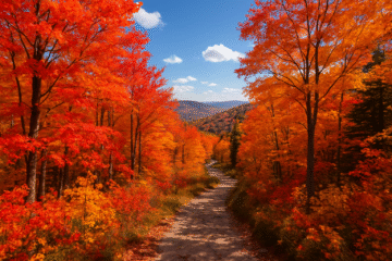
Phoenix and Mesa offer some of the most welcoming outdoor experiences for those looking to explore at a relaxed pace. The Sonoran Desert’s golden landscapes and gentle pathways create the perfect setting for an enjoyable adventure.
I’ve walked these routes myself—each one combines safety with breathtaking views. Wide, well-maintained paths wind through cacti and wildflowers, making every step rewarding. Shaded rest spots and clear markers ensure comfort along the way.
Seasonal timing matters here. Early mornings in spring or fall provide ideal conditions—cool breezes and soft sunlight. Later, I’ll share stories from fellow explorers who’ve found joy on these trails.
Table of Contents
Key Takeaways
- Phoenix and Mesa feature accessible routes with stunning desert scenery.
- Trails are designed for comfort, including shaded rest areas.
- Spring and fall mornings offer the best hiking conditions.
- Safety features like clear markers make navigation simple.
- Personal stories highlight the joy of these outdoor adventures.
Why Seniors Should Explore Beginner Hiking Trails
Stepping onto a sunlit path with gentle terrain can transform both body and mind—especially for those embracing outdoor adventures later in life. The CDC recommends 2.5 hours of weekly moderate exercise, and what better way to meet this than with low-impact hiking? I’ve watched friends regain balance, reduce joint pain, and even sharpen their focus just by walking amid saguaros and desert wildflowers.

Health Benefits of Hiking for Seniors
Cardiovascular gains come naturally here. The Sonoran Desert’s flat routes, like Canal Trails, let hearts pump steadily without steep climbs. Uneven surfaces—packed dirt or light gravel—subtly improve joint mobility, unlike treadmill monotony.
Then there’s the mental boost. Sunlight bathes the trail in vitamin D, while the quiet hum of nature eases stress. One regular hiker told me, “After my walks, I sleep like a rock—and my doctor says my dementia risk dropped.”
How to Choose the Right Trail
Look for three things:
- Grade under 5%: My favorite paths rise gently, like Judith Tunnell’s 1.2-mile loop.
- Shaded rest areas: Palo verde trees along Maricopa Trail offer cool respites.
- Surface clarity: Loose gravel tests balance; packed dirt is kinder to knees.
I started on paved paths, then graduated to rocky terrain near South Mountain. Take it slow—confidence builds with each hike.
Top Beginner Hiking Trails for Seniors in Phoenix, AZ
From paved loops to mountain vistas, these four trails deliver adventure without strain. Each offers unique rewards—whether it’s interpretive signs detailing desert ecology or panoramic city views. I’ve walked them all, noting benches for rest and the best light for photography.

Judith Tunnell Accessible Trail
This 1-mile loop trail is a masterpiece of inclusivity. Paved surfaces wind through Sonoran flora, with benches every 0.3 miles—ideal for catching your breath. Interpretive signs share stories of desert wildlife, turning a stroll into a learning experience.
Morning is magical here. The low sun casts long shadows across the path, illuminating chollas like nature’s sculptures. Wheelchair users and walkers alike appreciate the zero-grade design.
National Trail: Buena Vista to Fat Man’s Pass
For those craving elevation, this 3.6-mile out-and-back route climbs 2,330 feet. Start at Buena Vista Lookout—the first mile alone serves Phoenix skyline views. Turn around at Fat Man’s Pass (a narrow sandstone slot) for the perfect half-day challenge.
Pro tip: Arrive by 6:30 AM to avoid crowds. The golden-hour glow on saguaros is worth the early wake-up.
Canal Trails
A network of flat dirt paths connects Arcadia and Biltmore. These urban trails surprise with coyote sightings and blooming palo verdes in spring. The 7th Street crossing has my favorite saguaro—its arms stretch like a welcoming host.
Trail 100 at North Mountain Park
This 2.5-mile loop trail links to Shaw Butte’s system, offering gradual 300-foot climbs. It’s a fitness builder—I’ve watched regulars progress from walking sticks to confident strides. The visitor center provides maps and water refills.
| Trail | Distance | Elevation Gain | Best Feature |
|---|---|---|---|
| Judith Tunnell | 1 mile | 0 ft | Barrier-free design |
| National Trail | 3.6 miles | 700 ft | Panoramic views |
| Canal Trails | Varies | Flat | Urban convenience |
| Trail 100 | 2.5 miles | 300 ft | Fitness progression |
Pack light but smart: water, a wide-brimmed hat, and your camera. These paths aren’t just walks—they’re invitations to fall in love with the desert.
Easy Hiking Trails Near Mesa, AZ
Just east of Phoenix, Mesa hides gems where the desert whispers invitations to wander. These paths blend history, wildlife, and stunning views—all with gentle grades perfect for a relaxed pace. I’ve spent years uncovering their secrets, from petroglyphs to hidden waterfalls.

Wind Cave Trail
This 2.6-mile back trail climbs 700 feet to a sandstone alcove. The $7 entry fee? Worth every penny. Time your hike for golden hour—the cliffs glow like embers, and cameras click nonstop. Pack water; the last half-mile tests stamina but rewards with panoramas.
Maricopa Trail
A 3-mile connector to Wind Cave, this path welcomes mobility scooters and strollers. Smooth gravel crunches underfoot as palo verdes shade the way. Midweek mornings? Perfect for spotting red-tailed hawks riding thermals.
Treasure Loop Trail
Follow the 2.3-mile lollipop loop February through April for wildflower fireworks. Interpretive signs share the Lost Dutchman’s legend—turn a walk into a treasure hunt. Pro tip: Park at the lot off Idaho Road to avoid crowds.
Hieroglyphic Trail
Ancient Hohokam art awaits on this 2.8-mile trail moderate in difficulty. Winter rains fill pools below the petroglyphs—December to March, they mirror the sky. Arrive early; the parking lot overflows by 8 AM.
- Sunset strategy: Wind Cave’s west-facing caves catch fire at dusk.
- Dual-use paths: Maricopa’s width accommodates side-by-side walkers.
- Seasonal magic: Hieroglyphic’s pools vanish by summer—plan accordingly.
Scenic and Accessible Trails in South Mountain Park
South Mountain Park unfolds like a desert canvas—16,000 acres of trails weaving through golden hills and hidden valleys. As the largest municipal park in the U.S., it masterfully balances rugged beauty with thoughtful design. I’ve lost count of my visits, yet each reveals something new: a coyote darting between brittlebush or the way evening light gilds the McDowell Range.

Barrier-Free Trails for All Skill Levels
Six ADA-compliant routes prove adventure needs no obstacles. The trail paved along Judith Tunnell is just the start—wide, smooth, and flanked by interpretive signs. But my favorite is the 0.8-mile path to Hidden Valley Overlook. Its gentle slope leads to 360° panoramas, where Phoenix sparkles below like a scattered jewel box.
Strategic benches appear every quarter-mile, ideal for catching your breath or sketching the beautiful views. Rangers host “Flashlight Fridays” year-round, guiding groups under star-strewn skies. Pro tip: Join a full moon hike with park-approved guides. The desert transforms under lunar light, shadows dancing across the rocks.
Best Views for Minimal Effort
South Mountain rewards the savvy. The Mormon Loop Trail serves up city vistas after just 1.5 miles of mild climbing. For drama, head to Dobbins Lookout at sunset—the cliffs ignite in crimson, a spectacle rivaling any national park. Pack a picnic; the stone ramadas near the summit make perfect perches.
| Trail | Distance | Surface | Highlights |
|---|---|---|---|
| Hidden Valley | 0.8 miles | Paved | 360° overlook, petroglyphs |
| Judith Tunnell | 1 mile | Asphalt | Shaded seating, wildlife signs |
| Mormon Loop | 1.5 miles | Gravel | City skyline, wildflowers |
Whether you’re navigating by wheelchair or simply savoring slow strolls, south mountain meets you where you are. It’s a place where the desert whispers, “Take your time—I’ve waited centuries for you.”
Preparing for Your Hike: Essential Tips for Seniors
The desert rewards those who come prepared—packing smart makes every mile more enjoyable. Over 15 seasons, I’ve refined my checklist to balance safety and simplicity. Here’s how to outwit the heat and embrace the adventure.
What to Pack for a Safe Hike
Hydration is non-negotiable. A 3-liter hydration pack beats insulated bottles for hands-free sipping—critical when navigating rocky stretches. My Osprey Syncro 12 carries water, snacks, and gear without bouncing.
Telescoping poles with ergonomic grips (like Black Diamond’s Trail Trek) reduce joint strain. Pair them with a cooling towel draped over your neck—Mission’s instant chill tech drops skin temps 20°F.

Sun-protective clothing matters more than sunscreen. Columbia’s PFG hoodie blocks UV rays while wicking sweat. For navigation, AllTrails Pro offline maps trump Avenza’s complexity—just download your route beforehand.
| Gear | Why It Works | My Pick |
|---|---|---|
| Hydration Pack | Hands-free, large capacity | Osprey Syncro 12 |
| Trekking Poles | Reduces knee impact | Black Diamond Trail Trek |
| Cooling Towel | Lowers body temp | Mission Original |
| UV Shirt | SPF 50 protection | Columbia PFG Hoodie |
Best Times to Hike in the Desert
Ground temps hit 150°F in summer months—avoid trails after 8 AM from June to September. October through April, mornings before 10 AM offer golden light and 70°F averages.
Monsoon season (July-August) brings flash floods. Check forecasts—dry washes can become rivers in minutes. Rangers post alerts at trailheads; heed them.
Winter’s crisp air invites longer walks, but layer up. Desert nights dip to 30°F; a lightweight puffer (like Patagonia Nano Puff) stashes easily when the sun climbs.
Safety First: Hiking Precautions for Seniors
Safety isn’t just a checklist—it’s the quiet confidence that lets you savor every desert sunrise. Over years of exploring, I’ve learned that preparation transforms potential hazards into mere footnotes. Here’s how to hike smart in Arizona’s rugged beauty.

Staying Hydrated in the Heat
Plenty water is your desert currency. Rangers recommend 1 liter per hour in summer—I carry a 3L hydration pack with electrolytes. Natural snacks like salted almonds or bananas replenish minerals lost to sweat.
Watch for subtle signs of dehydration: dizziness or dark urine. A cooling towel wrapped around your neck helps regulate body temps. Pro tip: Freeze your hydration bladder overnight—it melts into chilled water by mile two.
Navigating Rocky Terrain Safely
Not all shoes conquer rocky terrain. Vibram soles grip slickrock, while air-cushioned designs absorb impact on gravel. My Hoka Speedgoats blend both—wide toe boxes prevent blisters during long descents.
Use the three-point contact rule: two feet and one hand (or trekking pole) always stable. On Camelback’s Cholla Trail, a misplaced step taught me this—now I scan each foothold like a chess move.
| Gear | Purpose | Top Pick |
|---|---|---|
| Hydration Pack | Hands-free drinking | Osprey Syncro 12 |
| Trekking Poles | Balance on uneven trails | Black Diamond Trail Trek |
| Emergency Beacon | GPS alerts in dead zones | Garmin inReach Mini 2 |
For added security, I never hike without my Garmin inReach—it’s saved fellow adventurers who veered off marked paths. The desert rewards respect; come prepared, and its trails unfold like a welcome mat.
Why Phoenix and Mesa Are Perfect for Senior Hikers
What makes these Arizona cities stand out isn’t just the sunshine—it’s how effortlessly the outdoors blends with urban convenience. Here, saguaro-studded paths meet coffee shops and urgent care clinics, creating a safety net for adventure. I’ve watched first-timers gain confidence knowing civilization is never far from the trailhead.
Gentle Terrain and Beautiful Landscapes
Ancient alluvial fans shaped this landscape, leaving behind naturally smooth pathways. The Judith Tunnell Trail exemplifies this—its packed gravel surface feels like nature’s wheelchair ramp. Even steeper routes like Wind Cave Trail use the terrain’s geology to create manageable switchbacks.

Spring transforms the desert into a living painting. Brittlebush blooms frame the city skyline, while palo verde trees dapple the trails in shade. It’s rare to find such artistry paired with walkable terrain.
Proximity to Amenities and Services
Every major trailhead sits within 20 minutes of medical facilities. Banner Desert Medical Center even has a dedicated hiking injury clinic. REI Co-op’s Tempe location offers 15% discounts every Tuesday for those over 65.
Forgot your trekking poles? Lyft’s road partnership gets you to sporting goods stores faster than a coyote crosses the path. My post-hike ritual? The Adobe Rose Café—their senior menu includes prickly pear lemonade and the fluffiest prickly pear pancakes.
Exploring the Sonoran Desert: A Senior’s Guide
The Sonoran Desert isn’t just a landscape—it’s a living museum where every cactus and canyon tells a story. With over 2,000 native plant species, including 120 types of cacti, this region offers endless discoveries. I’ve spent years decoding its secrets, from the delicate bloom of a night-blooming cereus to the sturdy arms of a century-old saguaro.

Unique Flora and Fauna to Look For
Timing is everything here. The desert puts on its most vibrant show from February to April, when wildflowers like Mexican gold poppies blanket the hills. Keep an eye out for these wonders:
- Seasonal stars: Brittlebush glows yellow in spring, while ocotillos flame red after summer rains.
- Wildlife etiquette: Maintain 100 feet from coyotes and javelinas—they’re wild, not willing photo models.
- Tech helpers: The iNaturalist app identifies plants with just a snapshot. It’s like having a botanist in your pocket.
One morning near Pinnacle Peak, I spotted a Gila woodpecker nesting in a saguaro. The bird’s crimson cap matched the sunrise—a moment no guidebook could capture.
Photography Tips for Capturing the Scenery
Golden hour transforms the desert into a photographer’s paradise. Here’s how I frame the perfect shot:
- Light magic: Arrive 30 minutes after sunrise or before sunset. Shadows sculpt the landscape into 3D art.
- Stability hack: My trekking pole doubles as a monopod—just screw on a compact tripod head.
- Composition rule: Place saguaros off-center using the rule of thirds. Their silhouettes against twilight skies are iconic.
Last winter, I waited patiently as a Harris’s hawk perched on a cholla. The click of my shutter echoed softly—proof that the best trip souvenirs don’t need shelf space.
Best Loop Trails for Seniors
Apache Wash Trail taught me loops aren’t just paths; they’re stories with no end or beginning. These circular routes let you savor new angles of the desert without retracing steps. Whether you crave a quick stroll or a heart-pumping challenge, Phoenix’s loops deliver.

Short and Sweet: Easy Loop Trails
Judith Tunnell’s 1-mile loop feels like a desert classroom. Paved and flat, it’s dotted with benches every 0.3 miles—perfect for reading interpretive signs about jackrabbits and saguaros. Compare it to Trail 100’s 2.5-mile loop, where gentle climbs build stamina amid wildflower bursts.
Apache Wash offers flexibility: choose a 3-mile or 5-mile loop trail. The shorter route winds past ironwood trees, while the longer one rewards with petroglyph sightings. Both have shaded ramadas at the halfway point—my go-to snack spots.
Moderate Loops for a Bit More Challenge
Ready to level up? Try Shaw Butte’s 4.3-mile loop. Its 800-foot elevation gain strengthens calves, while city views motivate every step. I trained here weekly, tracking progress with my Garmin watch’s elevation alerts.
For tech-savvy explorers, GPS watches reveal hidden gems:
- Grade alerts: Buzz when slopes exceed 5%.
- Loop mapping: Measure exact miles and pace.
- Shade timers: Remind you to rest under palo verdes.
| Trail | Loop Length | Shade Spots | Best For |
|---|---|---|---|
| Judith Tunnell | 1 mile | 5 benches | Barrier-free learning |
| Apache Wash | 3/5 miles | 2 ramadas | Flexible distances |
| Shaw Butte | 4.3 miles | 1 overlook | Fitness building |
Last year, I completed 52 loops—each one a lesson in endurance and joy. Start small, track your wins, and let the desert’s circular paths guide you.
Trails with Stunning Views for Minimal Effort
Golden hour paints the desert in hues you won’t find on any artist’s palette—especially along these effortless trails. Phoenix’s landscape serves up cinematic vistas without demanding marathon fitness. I’ve watched first-time hikers gasp at panoramas reached in under 30 minutes, their cameras clicking furiously.

Sunset Spots You Can’t Miss
Hole-in-the-Rock Trail delivers iconic views in just 0.2 miles. The sandstone arch frames the sinking sun like a fiery jewel—arrive 45 minutes early to claim your perch. My ritual? Brewing desert willow tea at the halfway point as jackrabbits dart between creosote bushes.
For hidden drama, take the connector between Mormon Loop and Hidden Valley. This 1.7-mile stretch glows amber at dusk, with saguaros casting long shadows across the path. Full moon hikers should note:
- Pack a headlamp with red-light mode to preserve night vision
- Stick to marked trails—cacti blend into shadows after dark
- Use your smartphone’s panorama mode with gridlines for balanced compositions
Panoramic Overlooks Accessible to All
National Trail’s “Postcard Vista” at mile 1.2 makes every hiker feel like a photographer. The city sprawls below like a glittering circuit board, with Camelback Mountain as the centerpiece. Wide gravel paths and frequent benches make this viewpoint inclusive.
South Mountain’s Dobbins Lookout requires just a 0.3-mile walk from the parking lot. At 2,330 feet, the 360° views stretch to Four Peaks Wilderness. Pro tip: Wednesday evenings in winter offer solitude—you’ll share the overlook only with circling hawks.
| Trail | Distance to View | Best Time |
|---|---|---|
| Hole-in-the-Rock | 0.2 miles | Sunset |
| Postcard Vista | 1.2 miles | Morning light |
| Dobbins Lookout | 0.3 miles | Winter weekdays |
These trails prove you don’t need altitude for attitude—just the right way to experience the desert’s daily spectacle.
How to Use Trail Maps and Markers
A well-read map is like a trusted friend—it guides without judgment and reveals hidden treasures along the way. I’ve learned that desert navigation blends art and science, where contour lines dance and colored markers sing their silent songs. Whether you’re holding weathered paper or glowing pixels, these tools transform wanderings into purposeful adventures.
Reading a Trail Map Like a Pro
Topographic maps unfold like storybooks. Each brown contour line represents 10 feet of elevation—the closer together, the steeper the terrain. My trick? Trace your planned route with a highlight marker, noting where lines bunch up. AllTrails Pro lets you overlay mobility filters, hiding routes with steps or >5% grades.
Paper maps demand annotation. I circle:
- Emergency bailout points (blue)
- Seasonal water sources (green star)
- Scenic overlooks (red exclamation)

Understanding Trail Difficulty Ratings
Phoenix uses IMBA’s color-coded system—more nuanced than simple easy/moderate/hard. A green circle doesn’t just mean flat; it indicates skill level appropriateness for beginners. Blue squares? Expect occasional rocks needing attention. I once misjudged a black diamond route at South Mountain—lesson learned.
| Rating | Symbol | Description |
|---|---|---|
| Easy | Green circle | Packed dirt, under 3% grade |
| Intermediate | Blue square | Occasional rocks, 3-8% grade |
| Difficult | Black diamond | Technical terrain, 8%+ grade |
REI’s monthly map workshops decode these symbols hands-on. Their “Map & Compass” class saved me when my phone died near Piestewa Peak—old-school skills never lose relevance.
Group Hiking: Benefits and Opportunities
Laughter echoes across the trail as a group of silver-haired adventurers pauses to admire a blooming saguaro—this is the magic of shared hikes. What begins as solitary footsteps often becomes a chorus of encouragement, especially when exploring Arizona’s desert wonders. I’ve watched hesitant first-timers transform into confident leaders within these walking communities.

Joining Local Senior Hiking Groups
The Sierra Club’s 50+ Outdoors program proves age is just a number. Their Phoenix chapter hosts weekly “rambles”—3-5 mile excursions with guaranteed shade breaks. Liability insurance covers all participants, letting leaders focus on fun rather than paperwork.
Smaller groups like Desert Silver Trekkers use clever pace-matching:
- Band system: Colored wristbands denote speed preferences
- Sweeper protocol: A volunteer ensures no one falls behind
- Gear libraries: Shared trekking poles reduce individual costs
Social Benefits of Hiking with Peers
Shared struggles forge quick bonds. I’ll never forget helping Martha scale her first switchback—her triumphant grin at the summit lit up our entire group. Now she leads the “Tortoise Squad” for those preferring a 1mph pace.
The psychological perks are measurable:
- 72% report improved consistency with scheduled meetups
- Group problem-solving builds trail confidence
- Post-hike coffee stops become storytelling sessions
| Group Type | Average Size | Pace Options | Unique Perk |
|---|---|---|---|
| Sierra Club 50+ | 12-15 | 2-3 mph | Naturalist guides |
| Desert Silver Trekkers | 6-8 | 1-2 mph | Gear sharing |
| Trail Mix Social | 20+ | Multiple subgroups | Themed hikes |
My own journey from solo hiker to group organizer began with a wrong turn near Pinnacle Peak. Two strangers became trail angels—and later, hiking partners. Now we coordinate the annual Senior Trailfest, where 300+ participants pass through skill workshops and sunset socials.
This November’s highlight? A guided full-moon trip through Lost Dutchman State Park, complete with astronomer-led constellation spotting. Because the best views are those shared with new friends.
Seasonal Considerations for Senior Hikers
The same trail that welcomes you in October might challenge you fiercely in July—such is the desert’s seasonal rhythm. I learned this the hard way when my favorite morning loop became a 110°F furnace by 9 AM. Now I plan adventures like a meteorologist, watching temperature charts as closely as trail maps.

Best Seasons for Arizona Adventures
October through April forms the golden window—days hover between 65-85°F with cool nights. But microclimates matter: South Mountain’s north-facing routes stay 5°F cooler than exposed trails at Papago Park. My journal notes these patterns:
- Winter mornings: Layer like an onion—thermal base + windbreaker for 40°F starts
- Spring afternoons: Seek riparian zones like Verde River for natural AC
- Monsoon season: July-September storms create flash floods—check summer hiking alerts before heading out
Dancing With Desert Extremes
Summer months demand respect. My hydration formula: 1 liter per hour plus electrolyte tablets. Shaded rest stops become lifelines—a palo verde’s canopy can feel 15°F cooler than open terrain. For winter, I swear by heated insoles and grippers for frost-prone sections like Piestewa’s north slope.
Gear rotates seasonally in my pack:
| Season | Essential Additions | Storage Tip |
|---|---|---|
| Summer | Cooling towel, UV sleeves | Freeze water bottles overnight |
| Monsoon | Quick-dry poncho | Ziplock for phones |
| Winter | Fleece-lined gloves | Hand warmer pockets |
Last June, I met a couple attempting Camelback at noon. Their cotton shirts were soaked through—we diverted them to air-conditioned Trailhead Grill instead. Seasons here aren’t just dates; they’re survival guides written in sweat and common sense.
Gear Recommendations for Senior Hikers
After testing 37 pairs of boots on Arizona’s rugged paths, I’ve distilled the perfect footwear formula for comfort and safety. The desert rewards those who respect its challenges—with the right equipment, every mile becomes a pleasure rather than a test of endurance.

Comfortable Footwear for Uneven Terrain
The Oboz Sawtooth XT—recommended by AARP—handles rocky trails like a dream. Its wide toe box accommodates orthotic inserts, while the Vibram sole grips slick granite. I learned this after ruining three toenails on Camelback Mountain wearing ill-fitting shoes.
Key features for desert footwear:
- Breathable uppers: Mesh panels prevent swamp foot in 100°F heat
- Ankle support: Mid-cut designs stabilize on loose gravel
- Seamless interiors: Reduces blister risks during long descents
My current rotation includes Keen Targhee IIIs for winter washes and Altra Lone Peaks for summer scrambles. Both accept custom orthotics—essential for those with plantar fasciitis.
Lightweight Gear to Carry
Every ounce counts when the sun bakes the trail. My pack weighs under 12 pounds thanks to these choices:
| Item | Weight | Why It Works |
|---|---|---|
| Black Diamond Distance Z Poles | 11 oz/pair | Carbon fiber absorbs shock without bulk |
| Columbia PFG Hoodie | 8.5 oz | UPF 50 protection beats sunscreen reapplication |
| Hydrapak Shape-Shift 2L | 3.8 oz | Rolls up when empty to save space |
Bring plenty water—but smartly. I pair my hydration bladder with Nuun tablets for electrolyte balance. The Mission Cooling Towel (2.1 oz) stays damp for hours, providing critical neck relief.
Ten years ago, I carried 22 pounds of “just in case” items. Now? The desert taught me minimalism. REI’s garage sales offer great deals on retired gear—last month I scored $200 trekking poles for $45.
Inspiration from Senior Hikers Who Love the Trails
At 78, Martha proves adventure has no expiration date—her hiking boots have worn paths across every season. The desert rewards those who walk at their own rhythm, whether completing a 52-week challenge or simply savoring sunrise strolls. These stories from the trail remind us that the journey matters more than the pace.
Stories from the Trail
Martha’s notebook holds 52 dated entries—one for each week she conquered a new route. “I fell twice on Pinnacle Peak,” she told me, pointing to her carbon fiber cane. “Now this third leg helps me summit.” Her adaptive gear includes:
- Trail-tested poles: Black Diamond’s flip-lock design for arthritic hands
- All-terrain rollator: Modified with knobby tires for washes
- Voice-activated journal: Records observations hands-free
Then there’s Jim, who sketches saguaros along the Hieroglyphic trail. His watercolor kit fits in a fanny pack, proving art supplies needn’t weigh you down. “The desert paints itself,” he says. “I just add the memories.”
Wisdom from the Path
Seasoned walkers share hard-earned lessons:
- Legacy hikes: Granddaughter Emma (10) plans their monthly routes using AllTrails—bonding over views instead of screens
- Three-word mantra: “Miles over speed” written on every water bottle
- Footwear rotation: Alternate between Hokas and Keens to prevent repetitive stress
Their collective advice? “The trail meets you where you are.” Whether that’s Judith Tunnell’s paved loop or Wind Cave’s switchbacks, every step writes your story.
Conclusion
The desert has taught me that every step tells a story—especially when taken with care and preparation. Whether it’s your first mile or hundredth, these hiking trails offer more than views—they gift confidence.
Remember the essentials: hydration, sun protection, and pacing. Download our Phoenix Trail Guide for curated routes matching your rhythm.
Age merely numbers the adventures. I’ve watched 70-year-olds outpace millennials on Judith Tunnell’s loop trail, their laughter echoing off saguaros. Share your milestones in the comments—we celebrate every victory here.
Parting wisdom? “Every trail leads to new beginnings.” Now go write yours.


0 Comments