Utah boasts the world’s largest concentration of slot canyons, making it a dream destination for adventurers. These narrow passages, carved by water and time, offer breathtaking views and thrilling hikes. Whether you’re a beginner or an expert, there’s a trail for you.
The state’s national parks feature diverse landscapes, from towering arches to winding crevices. Buckskin Gulch, one of the longest and deepest in the Southwest, provides varied entry points for different skill levels. Meanwhile, family-friendly spots like Willis Creek offer manageable water crossings and striking rock formations.
Safety is key when exploring these areas. Flash floods can be dangerous, so always check weather conditions before heading out. Proper gear, like waterproof shoes, is essential for trails with water crossings.
Table of Contents
Key Takeaways
- Utah has the highest number of slot canyons globally.
- Trails range from easy walks to challenging climbs.
- Safety precautions, like avoiding rain hikes, are crucial.
- Many routes feature unique rock colors and narrow passages.
- National parks provide well-maintained paths for all visitors.
Discover Utah’s Stunning Slot Canyons and Arches
Southern Utah’s dramatic landscapes are sculpted by nature’s forces, creating breathtaking slot canyons and arches. Over 65 million years of erosion carved iconic landmarks like Delicate Arch and Zebra Slot Canyon, each telling a story of Earth’s history.

Why Utah is a Hiker’s Paradise
The Colorado Plateau, spanning 1.87 million acres, serves as the geological foundation for these wonders. Zion and Arches National Parks showcase narrow canyons and soaring arches, formed by tectonic shifts and water erosion.
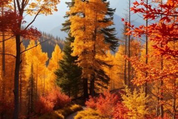
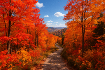
Spring and fall offer ideal hiking conditions. Cooler temperatures and vibrant desert hues enhance the experience.
The Unique Geology of Slot Canyons and Arches
Slot canyons like The Narrows were carved by relentless water flow, while arches resulted from differential erosion of sandstone. The table below highlights key differences:
| Feature | Formation Process | Example |
|---|---|---|
| Slot Canyons | Water/wind erosion | Buckskin Gulch |
| Arches | Weathering of sandstone | Delicate Arch |
Optimal seasons for exploring these rock formations are spring and fall, avoiding summer heat and monsoon risks.
Top 10 Hiking Trails in Utah for Slot Canyons and Arches
Stretching 20 miles through towering sandstone walls, Buckskin Gulch offers an unforgettable adventure. This continuous passage features 400-foot cliffs that narrow to just shoulder-width in places. It’s considered one of the most spectacular slot canyon experiences in the region.

Trailhead Options and Difficulty Levels
Three access points cater to different skill levels. The family-friendly Wire Pass Trail is a 3.5-mile round trip with ancient petroglyphs at the junction. More adventurous hikers can attempt the Middle Route, which requires navigating a 15-foot downclimb.
The open-ended Buckskin Main entrance allows for extended exploration. Guided tours are recommended for first-time visitors to navigate the technical sections safely.
Essential Planning Tips
BLM permits are mandatory for overnight stays. Spring and fall provide ideal conditions, with golden hour lighting creating stunning photo opportunities. Always check flash flood risks before entering narrow sections.
| Trailhead | Distance | Difficulty | Features |
|---|---|---|---|
| Wire Pass | 3.5 miles | Easy | Petroglyphs, wide passages |
| Middle Route | Varies | Challenging | Technical downclimb |
| Buckskin Main | Open-ended | Moderate | Continuous slot canyon |
Photographers should aim for early morning when sunlight filters through the narrowest sections. Sturdy footwear is essential for the rocky terrain and occasional water crossings.
Peek-a-Boo Gulch and Spooky Gulch: A Tight Squeeze
Spooky Gulch’s narrow confines and Peek-a-Boo’s arches create an unforgettable desert adventure. These twin canyons near Escalante deliver heart-pounding challenges with passages as tight as 10 inches wide.

What Makes These Canyons Unique
The 3.5-mile round trip loop contrasts Peek-a-Boo’s sculpted arches with Spooky Gulch’s extreme narrows. At Peek-a-Boo’s entrance, a 12-foot rock scramble tests agility.
Spooky Gulch demands sideways shuffling in sections narrower than a backpack. Leave large packs at the entrance—some gaps are barely shoulder-width.
Family-Friendly Considerations
Not recommended for kids under 10 due to tight squeezes and a 7-foot drop in Spooky Gulch. The Dry Fork trailhead requires a 26-mile drive down Hole-in-the-Rock Road, a rugged dirt path.
Plan for 3–4 hours and check weather forecasts—flash floods can fill these slots rapidly. Pair this hike with Devil’s Garden for a full-day adventure.
- Peek-a-Boo: Arches and potholes with occasional wading.
- Spooky Gulch: Claustrophobic twists requiring flexibility.
- Essential tip: Visit in spring/fall to avoid monsoon risks.
Zebra Slot Canyon: A Photographer’s Dream
Zebra Slot Canyon’s striped walls create a mesmerizing backdrop for photographers. The 5.3-mile round trip winds through narrow passages, some just 10 inches wide, with permanent water pools adding to the adventure. Vibrant rock formations reveal 170 million years of sedimentation, making every shot Instagram-worthy.

Navigating the Narrow Passages
The trail can be tricky to follow, but cairns mark the way through sandy stretches and tight squeezes. Hiking with a partner is recommended—some sections require sideways shuffling. Striped walls resemble zebra stripes, especially in low light, so adjust your camera settings for high contrast shots.
Preparing for Water Crossings
Standing water fills parts of the canyon year-round, sometimes reaching several feet deep. Waterproof shoes and extra clothing are essential—spring temperatures can be chilly. Visit April–June for manageable water levels and avoid summer’s 100°F+ heat.
- Best time to shoot: Mid-morning, when light filters through the narrowest sections.
- Shuttle tip: Arrange transport from Escalante BLM Visitor Center to the Hole-in-the-Rock Road trailhead.
- Pair this hike with Tunnel Slot Canyon for a full-day adventure.
Willis Creek Slot Canyon: Easy and Scenic
With its shallow creek crossings and wide passages, Willis Creek provides an accessible slot canyon experience. The 4.8-mile round trip winds through 100-foot-tall walls, with sections just 8 feet wide.

The first half-mile is wheelchair-accessible, offering sandstone views without technical challenges. Beyond this point, year-round water flows create 1-3 inch deep crossings—perfect for splashing in water shoes.
Access requires driving Skutumpah Road, a dirt path best navigated with high-clearance vehicles. Unlike busier Bryce Canyon trails, this route offers solitude and pioneer-era inscriptions carved into the walls.
Combine your visit with Bull Valley Gorge to see an old truck wreck embedded in the canyon. Morning light enhances the marbled walls and small waterfall near the trail’s end.
- Best gear: Quick-dry shoes with grip for creek crossings
- Photography tip: Capture striped rock patterns at midday
- Nearby alternative: Zebra Slot Canyon for more technical challenges
Burro Wash, Cottonwood Wash, and Sheets Gulch: Capitol Reef’s Hidden Gems
Few visitors discover Capitol Reef National Park’s trio of slot canyons, each with distinct geological features. These 8-mile round trip routes wind through sculpted narrows, historic ranching sites, and seasonal wildflower displays. Unlike crowded park attractions, these trails offer solitude amid towering Navajo sandstone.
Navigating Three Unique Challenges
Burro Wash demands technical skill with 12-foot chockstone climbs and shoulder-width passages. By contrast, Cottonwood Wash’s 3.3-mile route features manageable water pools and fewer obstacles. Sheets Gulch remains the least traveled, revealing pioneer artifacts at its 6.7-mile endpoint.
Spring hikers witness vibrant wildflowers framing the narrows from April-May. Helmets are advised due to loose rocks in Burro Wash’s steep sections. Carry 3L of water per person—shade is scarce beyond the canyon mouths.
| Canyon | Distance | Difficulty | Key Features |
|---|---|---|---|
| Burro Wash | 3.4 miles | Challenging | Technical chockstones, narrowest passages |
| Cottonwood Wash | 3.3 miles | Moderate | Water pools, wider rock formations |
| Sheets Gulch | 6.7 miles | Easy-Moderate | Historic artifacts, chamber-like pouroff |
Access all three via Notom-Bullfrog Road’s 7.8-mile marker. Morning light enhances the striped walls in Burro Wash, while Sheets Gulch’s open sections suit afternoon exploration. Combine shorter routes for a full-day adventure or tackle Sheets Gulch for backcountry solitude.
Little Wild Horse Canyon: Fun for All Ages
Little Wild Horse Canyon delivers adventure without extreme challenges, perfect for families. Its 8-mile loop connects to Bell Canyon, offering 100-foot-tall narrows with beautifully eroded walls. The trailhead sits just 5 miles from Goblin Valley State Park, making it an ideal add-on to park visits.
For shorter adventures, the “Most Slotty” 1.5-mile out-and-back section delivers the canyon’s best narrow passages. Sunrise starts beat crowds and showcase golden light on swirling rock formations. Unlike remote slots, this trail maintains excellent cell service—a safety plus for families.
Full moon nights reveal rare moonbows in the canyon’s tightest curves. Pair your hike with Goblin Valley’s mushroom-like rock formations for a full day of exploration.
| Route Option | Distance | Features | Best For |
|---|---|---|---|
| Full Loop | 8 miles | Bell Canyon connection, 328ft elevation | Experienced families |
| “Most Slotty” | 1.5 miles | Tightest narrows, no technical climbs | Young kids/quick visits |
Key tips for your visit:
- Footwear: Grippy soles for polished rock surfaces
- Timing: Arrive by 7am to secure parking at the trailhead
- Check flash flood risk—even distant rain can cause dangerous flows
The Narrows in Zion National Park: A Must-Do Hike
Towering 1,000-foot walls frame this legendary river hike in Zion National Park. The narrowest section of Zion Canyon challenges hikers to wade through the Virgin River, with water levels ranging from ankle-deep to chest-high. This 16-mile journey remains one of America’s most unforgettable aquatic trails.
Hiking the Virgin River
Water depth changes constantly, especially in the famous Wall Street section where it can reach 5 feet. Springdale outfitters rent drysuits ($45/day) and canyon shoes—essential gear for colder months.
Trekking poles help navigate slippery rocks in the current. Rangers close the route when flow exceeds 150 CFS or during flood warnings.
Permits and Planning
Wilderness permits are mandatory for the top-down route, with a 60% lottery success rate in peak season. The bottom-up approach from Temple of Sinawava requires no permit but limits distance.
| Route | Distance | Difficulty | Best For |
|---|---|---|---|
| Top-Down | 16 miles | Challenging | Overnight backpackers |
| Bottom-Up | 10 miles round trip | Moderate | Day hikers |
Shuttles from Springdale access Chamberlain Ranch for the top-down start. For photography, aim for golden hour when light beams illuminate the “Golden Cathedral” section.
- Pro tip: Visit September-October for warm water and fewer crowds
- Safety first: Always check flow rates at the visitor center
- Combine with Angels Landing for a classic Zion adventure
Fiery Furnace in Arches National Park: A Maze of Rock
Navigating Fiery Furnace feels like solving nature’s puzzle, with narrow passages and hidden arches. This 700-acre labyrinth in Arches National Park features 50+ named arches, including the photogenic Surprise Arch. Daily access is limited to 75 visitors, making permits highly competitive.
Permits require a 10-minute orientation video and verbal test at the visitor center. Rangers lead guided tours, but self-guided explorers must prove route-finding skills. A GPS watch helps track progress in the maze-like rock formations.
Scramble through tight slots using the “Keep Your Knees Bent” technique—this reduces strain on joints. Summer temperatures often exceed 110°F, so early morning hikes are safest.
| Option | Cost | Duration | Best For |
|---|---|---|---|
| Guided Tour | $16/person | 3 hours | First-time visitors |
| Self-Guided | $10 permit | Flexible | Experienced hikers |
Pair this adventure with Devil’s Garden Trail for a full-day itinerary. The Fiery Furnace’s unofficial paths can stretch beyond the 2-mile marked route.
- Pro tip: Book permits months ahead—they sell out within hours of release.
- Carry 3L of water; shade is rare in the furnace-like heat.
- Photograph Surprise Arch at midday for even lighting.
Kanarraville Canyon Falls: A Water-Filled Adventure
Cool water cascades through Kanarraville Canyon, creating a natural obstacle course for adventurous hikers. The 4.4-mile round trip features a 20-foot waterfall climb using a rustic ladder bolted into the canyon wall. This photogenic challenge rewards visitors with the Insta-famous “Red Cathedral” view at the midpoint.
$12 permits are required year-round, with only 150 issued daily. The parking lot fills quickly—arrive before 8am on weekends. Weekdays offer better availability for this increasingly popular slot canyon experience.
Water temperatures vary dramatically by season. Neoprene socks are recommended, especially when winter flows dip below 40°F. Summer brings warmer conditions but increased flash flood risks from April-May.
| Season | Water Temp | Conditions | Gear Tip |
|---|---|---|---|
| Summer | 70°F | Higher flow | Quick-dry shoes |
| Winter | 40°F | Low visibility | Neoprene layers |
The narrowest sections require sideways shuffling through ankle-deep flows. Unlike longer hikes like The Narrows, Kanarraville offers concentrated beauty in a manageable distance. Orange flag markers guide the way through the most technical areas.
Photographers should time their visit for midday light in the canyon’s tight curves. The ladder climb creates unique perspective shots—secure cameras before ascending.
Safety Tips for Hiking Slot Canyons and Arches
Sudden weather changes can transform scenic canyons into dangerous waterways within minutes. Proper preparation ensures these geological wonders remain thrilling rather than threatening. Always monitor conditions and pack essential gear—your vigilance could prevent emergencies.
Checking Weather Conditions
Tune to NOAA Weather Radio channel 162.550 MHz for real-time updates before and during your adventure. The Colorado Plateau’s arid climate makes storms unpredictable—clear skies can turn deadly in under an hour.
Follow the 3 Rain Rule: avoid canyons 24 hours before, during, and after rainfall. Summer monsoons pose the highest risk, particularly July-September.
Avoiding Flash Floods
Recognize these six warning signs of impending danger:
- Sudden water color changes to muddy brown
- Increasing debris flow in normally dry washes
- Distant thunder or rainfall upstream
- Rising water levels at your location
- Unusual roaring sounds echoing through canyons
- Yellow emergency cairns marking escape routes
The National Weather Service uses a 1-5 scale for flood risks. Never enter when levels reach 3 (moderate) or higher.
| Essential Gear | Purpose |
|---|---|
| Helmet | Protection from falling debris |
| Neoprene wetsuit | Hypothermia prevention |
| Probe pole | Testing water depth |
| Satellite messenger | Emergency communication |
For emergencies, contact BLM field offices:
- Moab: (435) 259-2100
- Kanab: (435) 644-1200
- Escalante: (435) 826-4291
Smart planning ensures your canyon hike remains a highlight rather than a hazard. Always share itineraries with someone reliable before departure.
Conclusion
From narrow squeezes to towering arches, this list showcases Utah’s diverse landscapes. Each trail offers unique adventure opportunities across the state’s national parks and hidden gems.
Remember to follow Leave No Trace principles. These fragile ecosystems require careful stewardship to preserve their beauty. New permit systems will launch in 2024 to better manage visitor impact.
Consider combining multiple locations into a road trip. Many canyons cluster together, making extended exploration easy. Always check weather forecasts—flash floods remain a serious risk in narrow passages.
For more route ideas, explore our guide to Utah’s stunning canyon network. Pack wisely, stay safe, and enjoy the world-class scenery this region offers.
0 Comments